
Length 268.6 km | ||
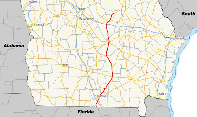 | ||
State Route 31 (SR 31) is a 166.9-mile-long (268.6 km) state highway that travels south-to-north through portions of Lowndes, Lanier, Clinch, Atkinson, Coffee, Telfair, Wheeler, Dodge, Laurens, and Johnson counties in the south-central part of the U.S. state of Georgia. The highway connects the Florida state line, south of Clyattville with Wrightsville, via Valdosta, Douglas, and Dublin.
Contents
Map of GA-31, Georgia, USA
Florida to Douglas
SR 31 begins at the Florida state line south-southeast of Clyattville, in Lowndes County, where the roadway continues as State Road 145. Almost immediately, it crosses over the Withlacoochee River. The highway curves to the northwest and back to the north and passes Oris Blackburn Memorial Park. It begins to curve to the northeast and enters Clyattville, where it meets the western terminus of SR 376 (Clyattville–Lake Park Road). The highway continues to the northeast and has an interchange with Interstate 75 (I-75). Approximately 1 mile (1.6 km) later, it skirts along the southeastern edge of Valdosta Regional Airport. At the intersection with Madison Highway, it turns to the right and becomes known as Inner Perimeter Road, part of an eastern bypass of most of the city. At South Patterson Street, US 41/SR 7 begin a concurrency to the northeast. This intersection also marks the southern terminus of US 41 Bus./SR 7 Bus. The next main intersection is SR 94 (New Statenville Highway). Then, it begins to curve to the north and enters the eastern city limits of Valdosta. Right after a slight bend to the north-northwest is an intersection with US 84/US 221/SR 38 (East Hill Avenue). At this intersection, US 221 joins the concurrency. After a curve to the northwest, the four highways intersect East Park Avenue. Here, US 221/SR 31 split off to the northeast and then leaves the city. The two highways travel through rural areas of the county, traveling southeast of Moody Air Force Base, and enter Lanier County. They continue to the northeast and gradually curve to the north-northeast. Along the eastern shore of Milltown Bay, they begin a northward routing and meet the western terminus of SR 31 Conn. (Murray Boulevard). Approximately 1,500 feet (460 m) later, they enter Lakeland. After a curve to the north-northwest, where SR 135 (South Mill Street) joins the concurrency, they enter the main part of town, where they intersect US 129/SR 11/SR 37/SR 122 (West Main Street). Here, both concurrencies merge and head to the east-northeast. Immediately, SR 135 departs to the north-northwest on North Carter Street. At Oak Street, SR 135 Byp. joins the concurrency. At North College Street, SR 135 Byp. leaves the concurrency to the north-northwest. This intersection also marks the eastern terminus of SR 11 Byp. The other six highways continue to the east-northeast, crossing over Big Creek before leaving town. Then, they cross over the Alapaha River. After that, US 221/SR 31/SR 122 depart the concurrency to the north-northeast. Just under 1 mile (1.6 km) later, SR 122 splits off, and US 221/SR 31 continue to the north-northeast, intersect SR 168, cut across the northwestern corner of Clinch County, and enter Atkinson County. A little over 1 mile (1.6 km) later, SR 64 joins the concurrency. The three highways continue to the north-northeast and intersect US 441/SR 89. At this intersection, SR 89 reaches its northern terminus, and US 441 joins the concurrency. In fact, US 441 is concurrent for over half of SR 31's total length. The concurrency continues into Pearson. There, they intersect US 82/SR 520 (Albany Avenue). At this intersection, SR 64 turns right onto US 82/SR 520. The other three highways continue to the north-northeast through rural areas of the county. Then, they curve to the north-northwest and enter Coffee County. Immediately, they curve to the north and cross the Satilla River. Then, they pass Pine Forests Memorial Gardens and enter Douglas.
Douglas to Wrightsville
They travel along the eastern edge of Douglas Municipal Airport. Farther to the north is an intersection with SR 135/SR 206 (Bowens Mill Road). At this intersection, SR 206 reaches its eastern terminus, and US 221 departs the concurrency. Farther to the north, they intersect SR 158 (Baker Highway). In the main part of town is an intersection with SR 32. On the northern edge of town is an intersection with SR 206 Conn. (North Connector Road). US 441/SR 31 curve to the northwest and enter Broxton, where SR 268 briefly joins the concurrency. After they leave town, they continue to the northwest and have a short concurrency with SR 107, a few miles south of Jacksonville. At the end of the concurrency, US 319 joins the concurrency. The three highways cross over the Ocmulgee River on the J.H. Millhollin Memorial Bridge, into Telfair County. Then, they curve to the north-northeast. When the concurrency enters Jacksonville, they intersect SR 117. Just before entering McRae, they meet the northern terminus of SR 149 Conn. Then, they enter town and intersect SR 132 on the southern edge of the city limits. Approximately 2,000 feet (610 m) later, US 280/SR 30 join the concurrency. In the central part of town is an intersection with US 23/US 341/SR 27. The five highways curve to the northeast and cross over the Little Ocmulgee River into Wheeler County. On the southeastern edge of Little Ocmulgee State Park, US 319/US 441/SR 31 depart to the north-northwest and skirt along the eastern edge of the park. They cut across a tiny part of Dodge County before entering Laurens County. The concurrent highways have an intersection with SR 46/SR 126. Northeast of Rentz, they have a second intersection with SR 117, which joins the concurrency. They curve to the north-northeast, pass Oconee Fall Line Technical College, and enter Dublin. Immediately is an interchange with I-16 (Jim Gillis Historic Savannah Parkway) and pass the Dublin–Laurens County Recreation Center. At the southern terminus of US 441 Byp., SR 117 departs the concurrency. At Joiner Street is the northern terminus of SR 257. In the central part of town, at an intersection with Martin Luther King, Jr. Drive, the three highways turn to the left onto South Monroe Street. Then, they intersect US 80/SR 19/SR 26 (Bellevue Avenue). At this intersection, the two concurrencies merge to the northeast. At Jefferson Street, US 441 departs to the north-northwest, concurrent with SR 29, which joins the concurrency. Also, SR 19 leaves the concurrency The five highways cross over the Oconee River on the Herschel Lovett Bridge, into East Dublin. In the city, US 319/SR 31 depart to the northeast. They travel through rural areas of the county, have a short section along the Laurens–Johnson county line, and enter Johnson County proper. The concurrency enters Wrightsville and curve to the east to an intersection with SR 15/SR 57/SR 78 (Marcus Street). At this intersection, SR 31 reaches its northern terminus, while US 319 continues to the east, concurrent with SR 78.
The following segments of SR 31 are included as part of the National Highway System, a system of roadways important to the nation's economy, defense, and mobility:
Lakeland connector route
State Route 31 Connector (SR 31 Conn.) is a 0.4-mile-long (0.64 km) connector route that exists entirely within the southeastern part of Lanier County. It is located just south of Lakeland and is known as Murray Boulevard for its entire length.
It begins at an intersection with US 221/SR 31 (Lakeland Highway). It travels due east to meet its eastern terminus, an intersection with SR 135 (College Street).
SR 31 Conn. is not part of the National Highway System, a system of roadways important to the nation's economy, defense, and mobility.
The entire route is in Lanier County.