
Length 369.8 km | ||
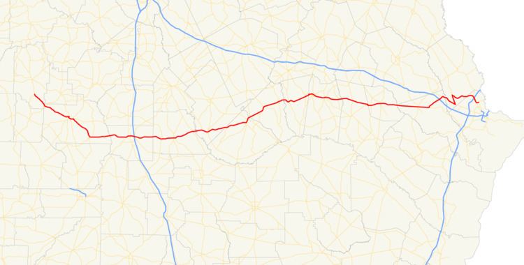 | ||
State Route 30 (SR 30) is a 229.8-mile-long (369.8 km) state highway that travels west-to-east through portions of Marion, Sumter, Crisp, Wilcox, Dodge, Telfair, Wheeler, Montgomery, Toombs, Tattnall, Evans, Bryan, Effingham, and Chatham counties in the south-central part of the U.S. state of Georgia. The highway connects the southern part of Marion County with Port Wentworth, via Americus, Cordele, Abbeville, McRae, Vidalia, Reidsville, Claxton, and Pembroke. The highway is concurrent with U.S. Route 280 (US 280) for about four-fifths of its length, from Americus to Blitchton, which is the eastern-most 183.9 miles (296.0 km) of US 280's length.
Contents
- Map of GA 30 Georgia USA
- Marion and Sumter counties
- Crisp and Wilcox counties
- Dodge and Telfair counties
- Wheeler and Montgomery counties
- Tattnall and Evans counties
- Bryan County
- Effingham and Chatham counties
- National Highway System
- References
Map of GA-30, Georgia, USA
Marion and Sumter counties
SR 30 begins at an intersection with SR 41 south-southeast of Buena Vista, in the south-central part of Marion County. The highway travels southeast through rural areas of the county and enters Sumter County. In Friendship is an intersection with SR 153. About 2.5 miles (4.0 km) later is the northern terminus of SR 45. Then, it continues to the southeast and curves to the east-northeast, to enter Americus. In the northern part of the city, it begins a concurrency with US 19/SR 3 (North Martin Luther King Boulevard). The three highways travel south-southeast, curve to the southwest, and reach West Lamar Street. At this intersection, SR 30 departs the concurrency by turning left onto US 280/SR 27/SR 49. In the main part of the city is an intersection with SR 377 (Lee Street). After passing Oak Grove Cemetery, SR 49 departs to the north on Tripp Street. Less than 3,000 feet (910 m) later, SR 27 departs to the east on Vienna Road, while US 280/SR 30 curve to the southeast. The concurrency passes Brickyard Plantation Golf Club and enters Leslie, where SR 195 (North Bailey Avenue) joins the concurrency. They curve to the east and enter De Soto. In this city, SR 195 departs the concurrency on North Luke Street. After a slight bend to the east-northeast, US 280/SR 30 travel through Cobb and cross over Lake Blackshear into Crisp County on the Gen. Howell Cobb–Capt. John A. Cobb Memorial Bridge.
Crisp and Wilcox counties
On the eastern side of the bridge, they skirt along the northern edge of Georgia Veterans State Park. After a short southeast section, they curve to the east. Then, they curve to the northeast and back to the east, where they enter Cordele. In downtown, they intersect US 41/SR 7/SR 90 (7th Street). At this intersection, SR 90 joins the concurrency. They gradually bend to the east-southeast and have an interchange with Interstate 75 (I-75). Less than 2,000 feet (610 m) later, SR 90 departs the concurrency. US 280/SR 30 travel in a fairly eastern routing and enter Wilcox County. They cross over the Alapaha River and enter Pitts. At 10th Street, they meet the northern terminus of SR 159. Just over 500 feet (150 m) later, SR 215 joins the concurrency. Shortly farther along their route, they enter Rochelle, where they intersect SR 112/SR 233 (Ashley Street). At this intersection, SR 215 leaves the concurrency to the south. After leaving the city, the concurrency travels to a northeastern direction and enters Abbeville, where is an intersection with US 129/SR 11 (Broad Street). Before leaving the city, they pass Riverside Cemetery. A little under 1 mile (1.6 km) after leaving the city, they cross over the Ocmulgee River into Dodge County.
Dodge and Telfair counties
In Copeland, they meet the southern terminus of SR 87. Farther along, in Rhine, is an intersection with SR 117/SR 165 (Central Street). At this intersection, SR 165 joins the concurrency. They travel through rural areas of the county and enter Milan, inside which the concurrency enters Telfair County. SR 165 departs the concurrency to the south on Mt. Zion Street. The concurrency heads east-northeast into McRae. In the southern part of town, they intersect US 319/US 441/SR 31, which join the concurrency. In downtown, the five highways intersect US 23/US 341/SR 27. Right after leaving town, they cross over the Little Ocmulgee River into Wheeler County.
Wheeler and Montgomery counties
On the southeastern corner of Little Ocmulgee State Park, US 280/SR 30 continue to the northeast, while the other three routes turn to the north-northeast. In Erick, the concurrency meets the northern terminus of SR 149. Then, in Alamo, is an intersection with SR 126 (Commerce Street). In Glenwood is an intersection with SR 19 (2nd Street). Then, they cross over the Oconee River on the LCPL Melvin Poole Memorial Bridge into Montgomery County. In Mount Vernon is an intersection with US 221/SR 56 (Railroad Avenue). The concurrency travels through nearby Ailey and enters Higgston. Here is an intersection with SR 15/SR 29 (James Street), which join the concurrency. This intersection also marks the northern terminus of SR 135. The four highways enter Vidalia and, a short distance later, enter Toombs County. At Adams Street, they intersect SR 130. At Jackson Street, SR 15/SR 29 depart the concurrency to the south-southwest, while US 280/SR 30 continue to the southeast, traveling south of Meadows Regional Medical Center and north of Vidalia Regional Airport. In nearby Lyons is an intersection with US 1/SR 4 (State Street). Then, they curve to the southeast and leave the city. They travel through rural areas of the county and enter Tattnall County.
Tattnall and Evans counties
Farther to the southeast, they skirt along the southwestern edge of Gordonia-Alatamaha State Park and enter Reidsville. There, US 280/SR 30 meet the southern terminus of SR 56 (Shepards Bridge Road) before they curve to the northeast. Almost immediately after the end of the curve is the northern terminus SR 147 (Tattnall Street). About 1,000 feet (300 m) later is an intersection with SR 23/SR 57/SR 121 (Main Street). The concurrent highway continue to the northeast, traveling south of Manassas and curve to the east to enter Evans County. In Bellville, is an intersection with SR 169 (Smith Street). Just outside the eastern city limits is the eastern terminus of SR 292. They travel through Hagan before entering Claxton. At North Ralph Street, SR 129 joins the concurrency. Just under 3,000 feet (910 m) later is an intersection with US 25/US 301/SR 73 (Duval Street). At South River Street, SR 129 departs from the concurrency to the south. In Daisy, they meet the northern terminus of former SR 250 (now known as Ellerbee Avenue). Farther to the east-southeast, they cross over the Canoochee River into Bryan County on the Moores Bridge.
Bryan County
US 280/SR 30 pass the Jerry Bacon Recreational Park. Continuing east-southeast, they enter Pembroke. At Main Street, SR 67 (from the left side of the concurrent highways) and SR 119 (from the right side) both join the concurrency. One block later, at College Street, those two highways depart the concurrency, traveling in opposite directions from how they joined (SR 67 turns right, while SR 119 turns left). Farther along, in Lanier, they meet the western terminus of SR 204 and curve to a more northeasterly direction. They travel southeast of Black Creek Golf Course. Then, they have an interchange with I-16 (Jim Gillis Historic Savannah Parkway). Just over 1 mile (1.6 km) later, in Blitchton, they intersect US 80/SR 26. At this intersection, US 280 reaches its eastern terminus, and SR 30 turns right onto US 80/SR 26 east. The three highways cross over the Ogeechee River into Effingham County.
Effingham and Chatham counties
After traveling through Eden, they intersect SR 17. At this intersection, US 80/SR 26 east/SR 17 south continue to the east-southeast, while SR 17 north/SR 30 east travel to the north-northwest. Approximately 3 miles (4.8 km) later, SR 30 splits off to the southeast on Noel C. Conaway Road. It curves to the northeast and back to a fairly eastward routing. Farther along, it enters Port Wentworth at the Chatham County line. North-northwest of the main par of town, it intersects SR 21 (Augusta Road). The two routes head concurrently to the south-southeast and have an interchange with I-95 (Tom Coleman Highway). They meet the current eastern terminus of Jimmy DeLoach Parkway. At Bonnybridge Road, SR 30 turns left and departs the concurrency. It meets a future interchange with Jimmy DeLoach Parkway. Just over 4,000 feet (1,200 m) after departing from SR 21, it meets its eastern terminus, an intersection with SR 25 (Coastal Highway).
National Highway System
There are two segments of SR 30 that are included as part of the National Highway System, a system of roadways important to the nation's economy, defense, and mobility: