
Length 23 km | ||
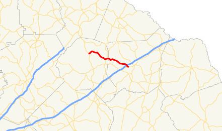 | ||
State Route 198 (SR 198) is a state highway that runs northwest–southeast for 14.3 miles (23.0 km) through portions of Banks and Franklin counties in the northeastern part of the U.S. state of Georgia.
Contents
Map of GA-198, Georgia, USA
Route description
The route begins at an intersection with US 441/SR 15 southeast of Baldwin, in Banks County. It curves to the southeast to an intersection with SR 63, just before crossing into Franklin County. It crosses over, but does not have an interchange with Interstate 85 just prior to meeting its eastern terminus, an intersection with SR 59 southwest of Carnesville.
References
Georgia State Route 198 Wikipedia(Text) CC BY-SA