
Length 288.1 km | ||
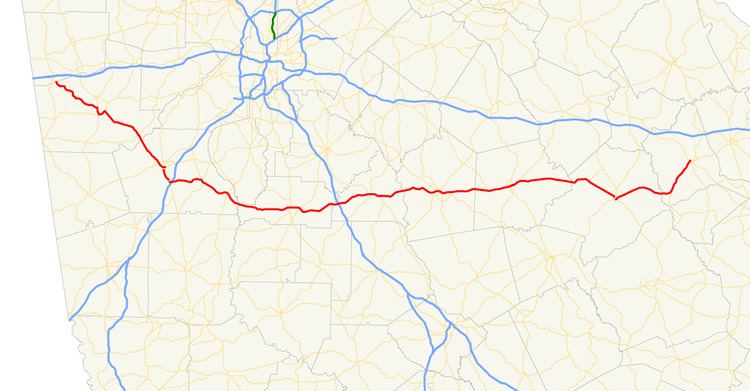 | ||
State Route 16 (SR 16) is a 179-mile-long (288 km) state highway that travels west-to-east through portions of Haralson, Carroll, Coweta, Spalding, Butts, Jasper, Putnam, Hancock, and Warren counties in the western and central parts of the U.S. state of Georgia. The highway connects the southeastern portion of Carroll County, northwest of Mount Zion to Warrenton, via Carrollton, Newnan, Griffin, Monticello, Eatonton, and Sparta.
Contents
Map of State Rte 16, Senoia, GA 30276, USA
Route description
SR 16 starts just south of Interstate 20 (I-20) in southwestern Haralson County, and travels southeast into Carroll County and Carrollton, where it begins a concurrency with US 27 Alt./SR 1. SR 16 continues through Whitesburg and crosses into Coweta County and through Newnan, where its concurrency with US 27 Alt. ends, crossing I-85 on the southeastern edge of East Newnan.
Turning sharply east, the highway travels through Sharpsburg, turns slightly southeast, and travels through Senoia into Spalding County, turning back east, and traveling into Griffin. Turning slightly northeast, SR 16 crosses I-75 at the county line with Butts County and travels into and through Jackson on into Monticello in Jasper County.
Continuing east, the route crosses into Putnam County, through Eatonton, then turns southeast at the county line with Hancock County, heading on into Sparta. Turning first slightly northeast, then southeast, SR 16 continues into Warren County, where it turns northeast once more and on to its eastern terminus in Warrenton.
There are two sections of SR 16 that are included as part of the National Highway System, a system of roadways important to the nation's economy, defense, and mobility: