
Length 140.7 km | ||
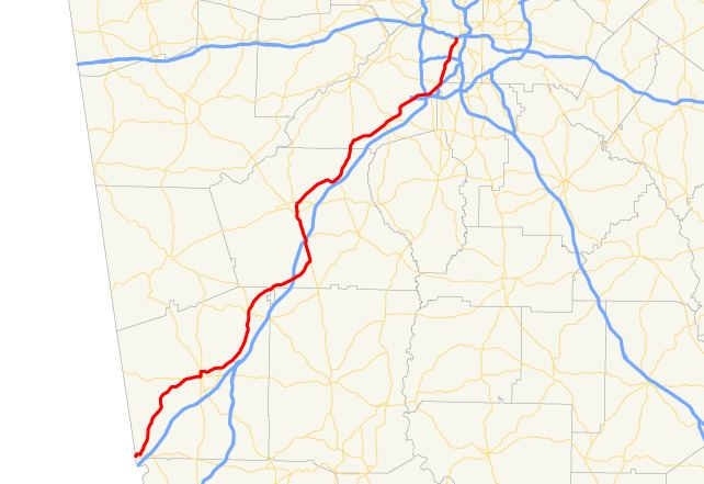 | ||
State Route 14 (SR 14) is a 87.4-mile-long (140.7 km) state highway that travels southwest-to-northeast through portions of Troup, Coweta, and Fulton counties in the west-central and north-central parts of the U.S. state of Georgia. The highway connects the Alabama state line in West Point to Downtown Atlanta, via LaGrange, Fairburn, College Park, and East Point. Except for the northernmost segment, it is entirely concurrent with U.S. Route 29 (US 29).
Contents
- Map of GA 14 Georgia USA
- Route description
- LaGrange connector
- LaGrange spur route
- PalmettoRed Oak alternate route
- Red OakCollege Park connector route
- References
Map of GA-14, Georgia, USA
Route description
SR 14 starts at its southern terminus just west of the Chattahoochee River in West Point in Troup County, and travels northeast through LaGrange, paralleling I-85 to the west, and is concurrent with US 29 for almost its entire length, with the exception of a brief distance at its northern terminus. US 29/SR 14 turns slightly north after leaving LaGrange and travels through Hogansville, then turns northeast again, traveling through Grantville, before crossing I-85 and traveling parallel to the interstate on its east side through portions of Coweta County.
The route then travels into Moreland, where it turns slightly northwest, crosses I-85 once more, and heads into Newnan. Turning northeast once more, the route crosses into Fulton County and heads through Palmetto, Fairburn, and Union City, before crossing I-285 west of Hartsfield–Jackson Atlanta International Airport. SR 14 then continues through East Point, crosses I-20, and arrives at its northern terminus at SR 154 and Ted Turner Drive NW in downtown Atlanta.
There are two sections of SR 14 that are included as part of the National Highway System, a system of roadways important to the nation's economy, defense, and mobility:
LaGrange connector
State Route 14 Connector (SR 14 Conn.) is Broad Street, a connecting spur of SR 14 in LaGrange in Troup County. The west end of the highway serves as the northern and western edge of LaGrange College. Between Waverly Way and Gordon Street, it is also the centerpiece of the Broad Street Historic District, and has a wrong-way concurrency with SR 219 from Greenwood Street to Morgan Street (US 27/US 29/SR 1/SR 14).
Originally the highway traveled along Greenwood Street to Hill Road to Hogansville Road ending at Commerce Road and Youngs Mill Road along a former US 29 Bus.
The entire route is in LaGrange, Troup County.
LaGrange spur route
State Route 14 Spur (SR 14 Spur) is a 5.0-mile-long (8.0 km) spur route of SR 14 in the southeastern part of LaGrange, in Troup County. It connects SR 219 in the southern part of the city with US 29/SR 14 northeast of the city.
It begins at an intersection with SR 219 (Whitesville Road). It curves to a northeasterly direction and intersects US 27/SR 1 (Hamilton Road). Then, it reaches SR 109 (Lafayette Parkway) just over 1 mile (1.6 km) before meeting its northern terminus, an intersection with US 29/SR 14 (Hogansville Road).
SR 14 Spur is not part of the National Highway System, a system of roadways important to the nation's economy, defense, and mobility.
The entire route is in LaGrange, Troup County.
Palmetto–Red Oak alternate route
State Route 14 Alternate (SR 14 Alt.) is a 13.7-mile-long (22.0 km) alternate route that exists entirely within the southern and southeastern parts of Fulton County. It connects Palmetto with Red Oak, located southwest of Atlanta. It is concurrent with US 29 Alt. for its entire length.
It begins at an intersection with US 29/SR 14 (Main Street) in Palmetto. This intersection marks the northern end of US 29/SR 14's concurrency with SR 154, with which US 29 Alt./SR 14 Alt. begin concurrent. The three highways travel north on a nearly due-north direction, until they reach South Fulton Parkway. There, the alternate routes turn to the right, toward Atlanta. The concurrency heads northeast, passing Cedar Grove Lake, and intersects SR 92 (Campbellton–Fairburn Road). They pass South Wind Golf Course and curve to a nearly due-east direction. In Red Oak, they have an interchange with US 29/SR 14 (Roosevelt Highway). Here, both US 29 Alternate/SR 14 Alternate meet their northern terminus, and the roadway continues as SR 14 Conn.
All of SR 14 Alt., from its northern intersection with SR 154 to its northern terminus, is included as part of the National Highway System, a system of roadways important to the nation's economy, defense, and mobility.
The entire route is in Fulton County.
Red Oak–College Park connector route
State Route 14 Connector (SR 14 Conn.; a.k.a. South Fulton Parkway) is a 2.8-mile-long (4.5 km) connector route in southern Fulton County, Georgia, United States. Its west end is at an interchange with US 29/SR 14 (Roosevelt Highway), where the roadway continues as US 29 Alt./SR 14 Alt. (South Fulton Parkway), it becomes a state maintained freeway. At the southwest interchange of I-85 and I-285, it becomes their collector/distributor roads. The C/D roads continue east through the SR 279 interchange to end at the northeast split of I-85/285.
All of SR 14 Spur is included as part of the National Highway System, a system of roadways important to the nation's economy, defense, and mobility.
Until the early-1990s, the western terminus of the road went past US 29 then curved to the south at a widened median, terminating near the current intersection of US 29 and Welcome All Road. This former section is on land now owned by the United States Department of Transportation.
The Georgia Department of Transportation has filled in the gap of South Fulton Parkway between Cochran Mill and Rivertown Roads. Since the 2006 completion of the highway, two counties (Douglas and Carroll) and local groups in South Fulton pushed for the state takeover of the route west of SR 14 Spur. The route was built by the county, but has been fully constructed to state highway standards and provides a fast route from Atlanta to southern Douglas County and Carrollton beyond, via SR 166.
In April 2007, GDOT accepted control of the highway, though no evidence of the new route existed until December 2007. The new route will be designated partly as US 29 Alt./SR 14 Alt. up to SR 154 and the remainder up to Campbellton–Redwine Road as a relocated SR 70 up to previously existing SR 70. In turn, existing SR 70 (Campbellton–Redwine Road and Cochran Mill Road) north of South Fulton Parkway to SR 154 (Cascade–Palmetto Highway) was decommissioned in addition to part of Cascade–Palmetto Highway (SR 70/SR 154) between SR 92 and SR 166. Respectively, SR 70/SR 154 were subsequently relocated along parts of SR 92 and SR 166 through Douglas County. The portion of South Fulton Parkway west of Old SR 70 into Douglas County remains a county road.
The entire route is in Fulton County.