
Country United States County Fulton Time zone Eastern (EST) (UTC-5) Zip code 30291 Local time Friday 12:23 PM | Elevation 968 ft (295 m) Area code(s) 770 Mayor Vince Williams (D) Population 20,458 (2013) | |
 | ||
Weather 19°C, Wind W at 24 km/h, 49% Humidity | ||
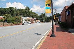
Union City is a city in Fulton County, Georgia, United States. The population was 19,456 at the 2010 census.
Contents
- Map of Union City GA USA
- City government
- Geography
- Demographics
- Elementary schools
- Middle schools
- High School
- Charter schools
- Colleges and universities
- References
Map of Union City, GA, USA
City government
The Elected Officials serve as the community’s decision-makers and consist of four(4) Council Members and one (1) Mayor.
The current Mayor is Vince Williams, and Council Members include: Brian Jones, Angelette Mealing, Shayla Nealy, and Joyce Robinson. The City Manager is LaSonja Filliingame and City Clerk is Jacquelyn Cossey. The City Manager and City Clerk are appointed by the Mayor and City Council to carry out the policies, directives and day-to-day business of the city. The Union City Planning Commission and the Zoning Board of Appeals are a citizen volunteer board and commission appointed by the City Council.
Geography
Union City is located at 33°34′42″N 84°32′36″W (33.578470, -84.543354).
According to the United States Census Bureau, the city has a total area of 19.3 square miles (50.0 km2), of which 19.1 square miles (49.5 km2) is land and 0.2 square miles (0.5 km2), or 0.83%, is water.
Demographics
As of the 2010 United States Census, there were 19,456 people residing in the city. The racial makeup of the city was 81.5% Black, 8.6% White, 0.2% Native American, 0.8% Asian, 0.0% Pacific Islander, 0.3% from some other race and 1.6% from two or more races. 7.0% were Hispanic or Latino of any race.
As of the census of 2000, there were 11,622 people, 4,974 households, and 2,750 families residing in the city. The population density was 1,353.2 people per square mile (522.3/km²). There were 5,332 housing units at an average density of 620.9 per square mile (239.7/km²). The racial makeup of the city was 69.33% African American, 25.36% White, 0.26% Native American, 1.26% Asian, 0.03% Pacific Islander, 2.04% from other races, and 1.72% from two or more races. Hispanic or Latino of any race were 5.22% of the population.
There were 4,974 households out of which 30.7% had children under the age of 18 living with them, 26.4% were married couples living together, 23.6% had a female householder with no husband present, and 44.7% were non-families. 38.5% of all households were made up of individuals and 15.5% had someone living alone who was 65 years of age or older. The average household size was 2.29 and the average family size was 3.05.
In the city, the population was spread out with 27.2% under the age of 18, 9.0% from 18 to 24, 33.6% from 25 to 44, 16.7% from 45 to 64, and 13.5% who were 65 years of age or older. The median age was 32 years. For every 100 females there were 79.1 males. For every 100 females age 18 and over, there were 71.3 males.
The median income for a household in the city was $35,322, and the median income for a family was $39,697. Males had a median income of $30,421 versus $28,111 for females. The per capita income for the city was $17,208. About 9.9% of families and 12.1% of the population were below the poverty line, including 14.0% of those under age 18 and 14.3% of those age 65 or over.