
Length 219.5 km | ||
 | ||
Counties | ||
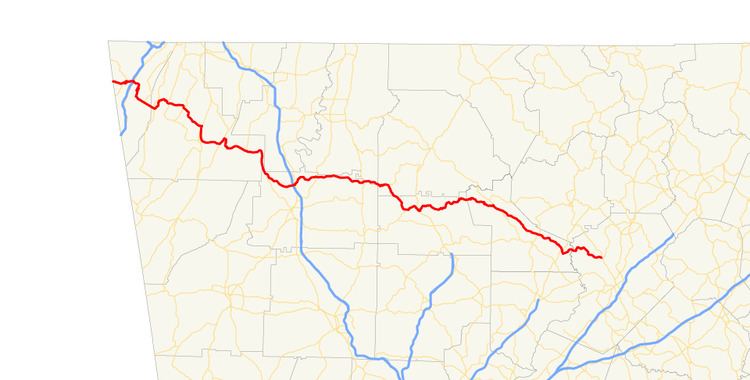
State Route 136 (SR 136) is a state highway that runs west–east through portions of Dade, Walker, Gordon, Murray, Gilmer, Pickens, Dawson, and Hall counties in northwestern and north-central Georgia. The route runs from its western terminus at SR 71 at the Alabama state line, west of Trenton, to its eastern terminus at SR 60 north of Gainesville.
Contents
- Map of GA 136 Georgia USA
- Route description
- Traffic
- History
- Calhoun connector
- Pickens County connector
- References
Map of GA-136, Georgia, USA
Route description
SR 136 initially heads east from the Alabama state line, where it continues into Alabama as SR 71 in the direction of Higdon. After passing the community of Gass, the route descends from about 1,600 feet down to under 1,000 feet elevation via two switchback turns as it approaches Trenton, the county seat of Dade County, which is located in the extreme northwest corner of the state of Georgia, bordering both Alabama and Tennessee. Just before running through Trenton, SR 136 crosses I-59, and then ascends again via switchbacks out of Trenton in a southerly direction up to an elevation of about 2,000 feet to the western border of Cloudland Canyon State Park, and cuts around the state park to its south to head southeast into Walker County. Just after crossing into Walker County, the route makes a sharp turn to the north and descends yet again down to an elevation of about 1,000 feet, then heads back east, now called Lookout Mountain Scenic Highway in reference to its proximity to Lookout Mountain in the area.
SR 136 meanders in a southeasterly direction, then intersects US 27/SR 1 just north of LaFayette, is co-signed with these two routes south through LaFayette, then splits off and runs east in the direction of Villanow, briefly running north and forming part of the western border of the Chattahoochee National Forest, then running south to find passable valleys, before cutting east through the national forest area. Just west of the county line with Whitfield County, the route cuts sharply south to cut through the Johns Mountain Wildlife Management Area, then enters Gordon County in its extreme northwestern corner, crosses I-75, and enters Resaca. SR 136 continues northeast, then east, out of Resaca and through the northern portion of Gordon County, intersects US 411/SR 61, then briefly crosses through the very southern section of Murray County, just south of Carters Lake, and passes into southern Gilmer County. There, the route cuts southeast, enters Pickens County, and turns back to the east as it approaches Talking Rock, crossing SR 5/SR 515 just west of Talking Rock.
SR 136 now meanders through the southern foothills of the Blue Ridge Mountains, gradually turning into a northeasterly direction, and crosses into Dawson County and is known as Gold Creek Highway. It again resumes a more southeasterly routing as it becomes briefly concurrent with SR 183 south of Amicalola Falls State Park. The route continues southeast, passing north of Dawsonville, to which it is connected via a former state route spur, now called Shoal Creek Road, and crosses SR 19/SR 400. SR 136 heads into Hall County as it crosses the Chestatee River branch of Lake Lanier, and arrives at its eastern terminus when it intersects SR 60 north of Lake Lanier and Gainesville.
Traffic
The Georgia Department of Transportation average annual daily traffic (AADT) numbers for the year 2011 show a variety of average daily traffic load numbers as the route travels across northern Georgia. Daily vehicle averages start with just under 3,500 vehicle east of the Alabama state line, but quickly rise from over 7,000 to just over 14,000 vehicles west of I-59, with numbers falling rapidly back to around 7,200 vehicles east of I-59, and decreasing closer to the averages seen in the rural areas of the route, namely of around 2,300 vehicles per day as the route approaches Walker County. Numbers stay in the mid-2,000 range to west of LaFayette, where they increase again into the mid-3,000 range, and reach their maximum as SR 136 is concurrent with US 27/SR 1, where averages reach just over 15,000 vehicles per day. East of the concurrency the vehicle load deceases to around 6,000 vehicles, going down to around 3,000 vehicles as the route runs through the Chattahoochee National Forest.
As SR 136 heads through Walker County, numbers again decrease to between 1,500 and 2,000 vehicles per day, increasing to between 3,000 and 4,000 vehicles in the vicinity of I-75 in Gordon County. East of I-75, the vehicle load returns to the rural average numbers of around 2,000 vehicles, not increasing again markedly until west of SR 5/SR 515, where the route feeds nearly 4,000 vehicles into the south-to-north route. East of SR 5, average numbers really drop, going from 1,700 all the way down to a route low of 370 in the western portion of Dawson County. Averages briefly increase to around 2,500 as the route is concurrent with SR 183, rise to around 3,100 north of Dawsonville, then fall as low as 1,400, but rise once again as SR 400 is approaching. Once in Hall County, the route sees a spike in its last few miles as it meets SR 60, where average vehicle numbers as just below 6,400 vehicles per day.
History
The first portion of the roadway that is signed as SR 136 today makes its appearance on Georgia state road maps in 1920, when portions of the current route, from Trenton to LaFayette (signed as SR 1), and from LaFayette east to today's SR 201 (signed as SR 2 at the time), were in existence. SR 2 continued its run to the northeast in the direction of Dalton, and the routing east of this intersection today was not extant in 1920. It was 1937 before a connecting route, signed as SR 143 at the time, was graded between this intersection and Calhoun; this section is made up today of SR 136, and SR 136 Connector from just inside Walker County. Also in 1937, the 36.3 miles (58.4 km) portion of the route from northwest of Dawsonville, where it intersects with SR 52 (signed as SR 43 at the time), and crossing US 19/SR 9, to Gainesville, is graded. It appears that the route connects directly into downtown Gainesville, and the portion of the route that is signed as SR 60 today, south of the route's current eastern terminus, was signed as SR 136 in 1937. In addition, the original portion of SR 2 had been improved to be covered in semi-hard surface.
By early in 1940, the portion of the route from its intersection with US 411/SR 61 to SR 53, which is made up of both SR 136 and SR 136 Connector in the area (signed as SR 156), were graded, as well as the eastbound portion from where the connector route splits off south, to Talking Rock, on the SR 136 main routing (signed as SR 154 at the time). By the beginning of 1941, another part of the route, from an intersection with SR 108 northeast of Jasper to the intersection with SR 183, was graded and also signed as SR 154, and connected to SR 136 into Gainesville.
In 1946, the designation of SR 136 was added for the short stretch of the route between Blaine and Talking Rock, just west of Talking Rock. The signage of SR 154 disappeared at the same time, as the portion from SR 108 that had been signed as SR 154 was re-signed as SR 136. In addition, portions of the route, namely the original SR 2 stretch in Dade and Walker counties to Villanow, the short stretch between Blaine and Talking Rock, and the final portion of SR 136 into Gainesville (which is signed as SR 60 today) were completed in hard surface. Finally, the portion of the route from the Alabama state line to Trenton had been graded and designated as part of SR 2. By 1949, the part of the route from the Alabama state line to Calhoun had all been re-designated as SR 143. The portion in Gordon County was still missing, and the route at the time picks up again as SR 136 west of Talking Rock (in Blaine), is concurrent with SR 5, then SR 108, before again appearing as SR 136 from northeastern Pickens County to its eastern terminus.
By 1957, a majority of the route had been finished in hard surface; only a portion of SR 143 in southern Walker and northwestern Gordon County, the SR 156 portion, and the stretch in Dawson County from US 19/SR 9 to the former SR 9E were unfinished. In addition, the final stretch of the route into Gainesville had been re-designated as SR 60, fixing SR 136's eastern terminus at its current location. It was 1969 before the first indication of the missing part of the route appeared on Georgia state highway maps; namely, the portions of the route northwest of Calhoun to Resaca, and then from SR 225 in Nickelville to US 411/SR 61, are mapped as roads (but not yet state routes). The portion between Resaca and US 411 was not indicated until 1971, and it was 1973 before the section northwest of Resaca was added to the state route system as SR 143 Connector.
In 1979, almost the entire route as it runs today was designated as SR 136. This meant the re-designation from SR 143 for the portion from the western terminus to Resaca (as well as re-designation of SR 143 Connector to SR 136 Connector into Calhoun), the initial designation of the portion from Resaca to US 411 as SR 136, and the re-designation of SR 156 between US 411 and Talking Rock. The one missing piece was the connection between Talking Rock and SR 52; at the time, that connection was still made by the former SR 108, which today is named Burnt Mountain Road, and which intersects SR 136 north of Jasper. It was 1982 before SR 108 disappears, and SR 136 connects all the way from the Alabama state line to north of Gainesville.
Calhoun connector
State Route 136 Connector in Calhoun continues south into downtown Calhoun as the main route of SR 136 makes a turn to the east and bypasses Calhoun to its north. The connector route terminates at its intersection with SR 53 Spur in the heart of Calhoun. Until 1973, this routing into and through Calhoun was part of the state route system, and this portion of the route was signed as SR 143. After 1973, the new routing to the north of Calhoun was put into operation, and the connector was signed as SR 143 Connector until 1979, when both portions were re-designated as SR 136 and SR 136 Connector, respectively.
The entire route is in Calhoun, Gordon County.
Pickens County connector
State Route 136 Connector in Pickens County is a 2.653-mile (4.270 km) connecting route running slightly southwest from the main route of SR 136 in Blaine to its intersection with SR 53 in Hinton. The main route continues east in the direction of Talking Rock. The connector was first constructed in 1940 and was signed as SR 156 at the time, running from SR 53 in the direction of SR 5. It was 1979 before the route was re-designated as SR 136 Connector.