
Length 605.1 km | ||
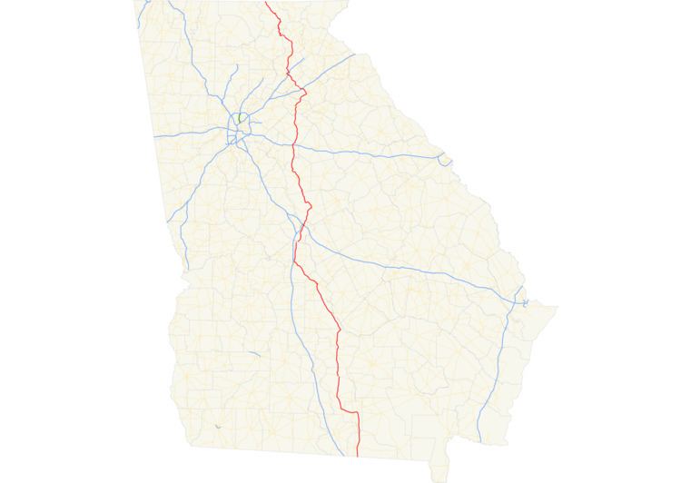 | ||
State Route 11 (SR 11) is a 376-mile-long (605 km) state highway in the U.S. state of Georgia, traveling through portions of Echols, Lanier, Berrien, Irwin, Ben Hill, Wilcox, Pulaski, Houston, Peach, Bibb, Jones, Jasper, Newton, Walton, Barrow, Jackson, Hall, White, Lumpkin, and Union counties. It travels the entire length of the state from south to north, connecting the Florida state line with the North Carolina state line, roughly bisecting the state into two equal parts. It is the longest route in the state. The portion from the southeastern city limits of Monticello to the Jasper–Newton county line is included in the Monticello Crossroads Scenic Byway.
Contents
- Map of State Hwy 11 Georgia USA
- Route description
- Lakeland bypass
- Lakeland connector
- Hawkinsville business loop
- Perry business loop
- Perry connector
- ArcadeJefferson connector
- Jefferson business loop
- Gainesville business loop
- Gainesville connector
- Blairsville truck route
- References
Map of State Hwy 11, Georgia, USA
Route description
The route begins at the Florida state line south of Statenville. The route travels north concurrent with US 129 through Statenville, Lakeland, Nashville, Ocilla, Fitzgerald, and Abbeville, before arriving in Hawkinsville. In Hawkinsville, SR 11 departs US 129 and runs concurrent with US 341 northwest to Perry. There, SR 11 departs and runs concurrent with US 41, and eventually, US 129 again, north to Macon. SR 11 leaves Macon concurrent with US 129 and SR 22. In Gray, SR 11 departs, and travels north, without being concurrent with a U.S. Highway. In Jefferson, the route again runs concurrent with US 129. The two routes continue north, passing through Gainesville. Further north, SR 11 and US 129 are joined by US 19. The three routes climb over and descend the mountains, and continues north to the North Carolina state line, where SR 11 meets its northern terminus.
The following sections of SR 11 are included as part of the National Highway System, a system of roadways important to the nation's economy, defense, and mobility:
Lakeland bypass
State Route 11 Bypass (SR 11 Byp.) is a 0.6-mile-long (0.97 km) bypass for SR 11 in Lakeland. It consists of West Church Avenue and East Church Street and then turns south onto North College Road (SR 135 Byp.). It also travels concurrently with SR 135 between North Center Street and North Temple Street.
The entire route is in Lakeland, Lanier County.
Lakeland connector
State Route 11 Connector (SR 11 Conn.) is a marked segment of North Pecan Street between SR 122 and US 129/SR 11/SR 37 in Lakeland.
The entire route is in Lakeland, Lanier County.
Hawkinsville business loop
State Route 11 Business (SR 11 Bus.) is a business route of SR 11 in Hawkinsville. It also travels in a concurrency with US 129 Bus./US 341 Bus. and part of SR 26.
Perry business loop
State Route 11 Business (SR 11 Bus.) is a business route and former mainline of SR 11. It begins at the "Perry Parkway" (US 341 Byp./SR 11), and travels concurrently with US 341 into downtown Perry. At Houston Lake Road, the highway joins a concurrency with SR 127, until it reaches Ball Street, where US 341/SR 11 Bus. turns right towards the northwest. The concurrency with US 341 comes to an end two blocks later at the intersection with US 41 (Commerce Street), and it then turns right. US 41/SR 11 Bus. is carried by Commerce Street until that street terminates at Macon Road, and the concurrency make a left turn, following that street north until it reaches the Perry Parkway again. SR 11 Bus. ends at this segment of Perry Parkway, SR 11 travels concurrent with US 41 north of the parkway, and US 341 Byp. travels concurrent with SR 11 Conn.
Perry connector
State Route 11 Connector (SR 11 Conn.) is a 2.8-mile-long (4.5 km) connecting route of SR 11 located northwest of the main part of Perry, and is the concurrent state road for US 341 Byp. from US 41/SR 11/SR 11 Bus. to US 341/SR 7. It also has an interchange with I-75. It is known as Perry Parkway for its entire length.
The entire route is in Perry, Houston County.
Arcade–Jefferson connector
State Route 11 Connector (SR 11 Conn.) is a 3.1-mile-long (5.0 km) connecting route between US 129 Bus./SR 15 Alt. in Arcade and SR 11 and the southern terminus of SR 11 Bus. west of Jefferson. The highway, which is named "Jefferson Bypass", is entirely concurrent with US 129, and the only other major intersections are SR 82 and former SR 319 (Etheridge Road).
The entire route is in Jackson County.
Jefferson business loop
State Route 11 Business (SR 11 Bus.) is a 5.4-mile-long (8.7 km) business route of SR 11 that is mostly within the city limits of Jefferson. It is a former section of SR 11. The highway begins at and intersection with US 129, SR 11, and the northern terminus of SR 11 Conn., where SR 11 turns north onto US 129. The street name is Winder Highway at first, until it reaches the intersection with Memorial Drive where it becomes Lee Street. Between Epps Street and Cobb Street, the route curves to the southeast as Railroad Avenue branches off to the left and it passes by a local antiques store next to a grade crossing with a CSX line. The southeast curve ends just before the intersection with Railroad Street, and the highway has a later intersection with Oak Street and Hill Street, the former of which travels along the west side of the Woodbine-Jefferson City Cemetery and then enters the Jefferson Historic District just before encountering the western terminus of US 129 Bus./SR 15 Alt./SR 82. Two blocks later, SR 11 Bus. turns left onto Washington Avenue along with US 129 Bus., while SR 15 Alt./SR 82 continue east onto Sycamore Street towards Commerce and the Gainesville metropolitan area respectively. SR 11 Bus. continues to travel concurrently with US 129 Bus. for the rest of its length until both highways terminate at US 129/SR 11 north of Jefferson.
The entire route is in Jackson County.
Gainesville business loop
State Route 11 Business (SR 11 Bus.) is a 3.2-mile-long (5.1 km) business route of SR 11 in Gainesville. It travels along Athens Highway from US 129 Bus./SR 11/SR 60/SR 369 in the central part of the city to US 129/SR 11 in the northeast part of the city.
SR 11 Bus. begins as a continuation of Athens Highway (E.E. Butler Parkway), which also takes the concurrency with SR 60 away from SR 369. SR 11 Bus./SR 60 travels along Athens Highway until the intersections with Academy Street Northwest and Academy Street East, where the name changes to Green Street. North of the First Baptist Church of Gainesville, SR 11 Bus. branches off to the northeast onto Riverside Drive, while SR 60 continues north along Thompson Bridge Road. Immediately after SR 60 Conn. (Oak Tree Drive), Riverside Drive turns left towards the Riverside Military Academy, and SR 11 Bus. moves onto Morningside Drive, which winds through a wooded residential area until it encounters a row of billboards on the southwest corner of a local street named Park Hill Drive, then adopts that street name as its own. As Park Hill Drive, SR 11 Bus. encounters the northern terminus of SR 11 Conn. across from South Enota Drive Northeast. The road gains the name Cleveland Highway after Roper Hill Road, then curves more towards the north after the intersection with Old Clarks Bridge Road, and later encounters the western terminus of SR 284 (Clarks Bridge Road NE) across from a local dead end street named Northeast Barrett Street. One last local intersection (Lakeville Drive) branching off to the northwest and the entrance to the Chattahoochee–Oconee division of the United States National Forest Service can be found before SR 11 Bus. ends at US 129/SR 11 (Limestone Parkway/Cleveland Highway).
The entire route is in Gainesville, Hall County.
Gainesville connector
State Route 11 Connector (SR 11 Conn.) is an unsigned connecting route between US 129 Bus. and SR 11 Bus. along eastern downtown Gainesville. Street names include Downey Boulevard, and South Enota Drive.
Blairsville truck route
State Route 11 Truck (SR 11 Truck) is a truck route of SR 11 that travels concurrent with U.S. Route 129 Truck (US 129 Truck) for its entire length. It also has a concurrency with US 76/SR 2/SR 515.
The entire route is in Union County.