
Length 93.5 km | ||
 | ||
Counties | ||
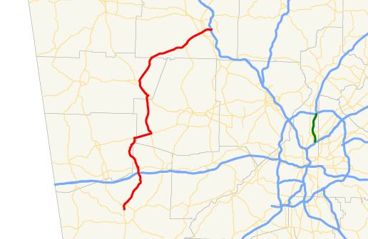
State Route 113 (SR 113) is a state highway in western Georgia. It is a 58.1-mile-long (93.5 km) route, connecting US 27/SR 1 in Carrollton and Interstate 75 (I-75) in Cartersville.
Contents
Map of GA-113, Georgia, USA
Route description
SR 113 begins at an intersection with US 27/SR 1 in Carrollton. The highway travels north, intersects I-20, then travels through the town of Temple. In extreme eastern Haralson County, the route begins a concurrency with SR 120 traveling east, then travels concurrent with SR 101 northward. North of Yorkville, SR 101/SR 113 also travels concurrent with US 278/SR 6 to Rockmart. The highway departs Rockmart to the northeast. After crossing the Etowah River, the highway travels through downtown Cartersville as Main Street, before reaching its northern terminus at I-75 in the eastern part of Cartersville. SR 113 is usually marked as a north–south signed highway, but in areas like Taylorsville, the highway is signed as an east–west route. It is also signed as an east–west highway at its northern terminus at I-75.