
Continent Africa Area Ranked 93rd | Region Northern Africa Coastline 1,148 km (713 mi) | |
 | ||
Highest point Jebel ech Chambi1,544 m | ||
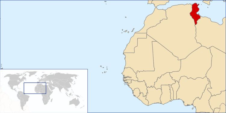
Tunisia is a country in Northern Africa, bordering the Mediterranean Sea, having a western border with Algeria (965 km) and south-eastern border with Libya (459 km) where the width of land tapers to the south-west into the Sahara. The country has north, east and complex east-to-north coasts including the curved Gulf of Gabès, which forms the western part of Africa's Gulf of Sidra. Most of this greater gulf forms the main coast of Libya including the city of Sirte which shares its root name. The country's geographic coordinates are 34°00′N 9°00′E. Tunisia occupies an area of 163,610 square kilometres, of which 8,250 are water. The principal and reliable rivers rise in the north of the country with a few notable exceptions from north-east Algeria and flow through the northern plain where sufficient rainfall supports diverse plant cover and irrigated agriculture.
Contents
Maritime claims
Physical geography
Tunisia is on the Mediterranean coast of North Africa, midway between the Atlantic Ocean and the Nile Delta. It is bordered by Algeria on the west and Libya on the south east. It lies between latitudes 30° and 38°N, and longitudes 7° and 12°E. An abrupt southward turn of the Mediterranean coast in northern Tunisia gives the country two distinctive Mediterranean coasts, west-east in the north, and north-south in the east
Tunisia is about the size of the American state of Wisconsin. Despite its relatively small size, Tunisia has great environmental diversity due to its north-south extent. Its east-west extent is limited. Differences in Tunisia, like the rest of the Maghreb, are largely north-south environmental differences defined by sharply decreasing rainfall southward from any point.
The Dorsal, the eastern extension of the Atlas Mountains, runs across Tunisia in a northeasterly direction from the Algerian border in the west to the Cape Bon peninsula in the east. North of the Dorsal is the Tell, a region characterized by low, rolling hills and plains, again an extension of mountains to the west in Algeria. In the Khroumerie, the northwestern corner of the Tunisian Tell, elevations reach 1,050 meters (3,440 feet) and snow occurs in winter. The Sahel, a broadening coastal plain along Tunisia's eastern Mediterranean coast, is among the world's premier areas of olive cultivation. Inland from the Sahel, between the Dorsal and a range of hills south of Gafsa, are the steppes. Much of the southern region is desert. Tunisia has a coastline 1,148 kilometres (713 miles) long. In maritime terms, the country claims a contiguous zone of 24 nautical miles (44 kilometres; 28 miles), and a territorial sea of 12 nautical miles (22 kilometres; 14 miles).
Rivers
The Medjerda River rises in Algeria and flows east through the third of the country with reliable rivers, the north. It empties into the Gulf of Tunis and Lake of Tunis. At 450 km (280 mi) it is the longest river. It is also known as the wādi (or oued) Majardah and Wadi Mejerha and it was known as Bagrada in ancient times. It rises in a further section of the Tell Atlas in Algeria, staying to the south of the Tell escarpment while within the country. It has been dammed at the Sidi Salem Dam. The Oued Zouara rises in the country's own section of the Tell. It has been dammed by the Sidi el Barrak Dam which forms a large lake widely used across the north and centre of the country in an advanced water management project.
Climate
Tunisia's climate is hot-summer Mediterranean climate (Köppen climate classification Csa) in the north, where winters are mild with moderate rainfall and summers are hot and dry. Temperatures in July and August can exceed 40 °C (104 °F) when the tropical continental air mass of the desert reaches the whole Tunisia. Winters are mild with temperatures rarely exceeding 20 °C (68 °F) (exception is the south-west of the country). The south of the country is desert. The terrain in the north is mountainous, which, moving south, gives way to a hot, dry central plain. As we go to the south, the climate naturally becomes hotter, drier and sunnier. The southern part has therefore a hot desert climate (Köppen climate classification BWh) with extremely hot summers, warm winters and very low annual rainfall amount. Daytime temperatures consistently turn around 45 °C (113 °F) during summers. However, the warmth of winters is only during daytime because nights can be cold in the desert. A series of salt lakes, known as chottzz or shatts, lie in an east-west line at the northern edge of the Sahara Desert, extending from the Gulf of Gabes into Algeria. The lowest point is Chott el Djerid, at − 17 m (−55.8 ft), and the highest is Jebel ech Chambi, at 1,544 metres (5,066 ft). Annual average rainfall amount is lower than 500 mm (19.68 in) nearly everywhere in Tunisia. Tunisia is therefore a dry, semi-arid country. Areas with a pre-Saharan climate receive below 250 mm (9.84 in) and areas with a typical Saharan climate receive below 100 mm (3.94 in) of annual average precipitation. The southernmost part receives rainfall as low as 50 mm (1,97 in) in areas around El Borma, along the Algerian border.
Natural resources
Tunisia possesses petroleum, phosphates, iron ore, lead, zinc, salt and arable land. 3,850 km2 of land is irrigated in Tunisia. The use of land in the country is demonstrated in the following table.
Environment
Current environmental issues for Tunisia include:
Tunisia is a party to the following international agreements: Biodiversity, Climate Change, Climate Change-Kyoto Protocol, Desertification, Endangered Species, Environmental Modification, Hazardous Wastes, Law of the Sea, Marine Dumping, Ozone Layer Protection, Ship Pollution (MARPOL 73/78) and Wetlands. Tunisia has signed, but not ratified the Marine Life Conservation agreement.
Tunisia, like other North African countries, has lost much of its prehistoric biodiversity due to the ongoing expanding human population; for example, until historic times there was a population of the endangered primate Barbary macaque (Macaca sylvanus). The monk seal is now extirpated (locally extinct).
Extreme points
This is a list of the extreme points of Tunisia, the points that are farther north, south, east or west than any other