
Adjacent bodies of water Atlantic Ocean Coastline 4,970 km (3,088 mi) Highest point Hvannadalshnúkur Peak Hvannadalshnúkur | Area rank 18th Highest elevation 2,110 m (6,920 ft) Area 103,001 km² | |
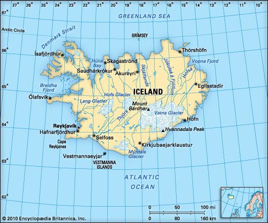 | ||
Largest settlement Reykjavík (pop. 118,861) | ||
Iceland is an island country at the confluence of the North Atlantic and Arctic Oceans, east of Greenland and immediately south of the Arctic Circle, atop the constructive boundary of the northern Mid-Atlantic Ridge about 860 km (534 mi) from Scotland and 4,200 km (2,610 mi) from New York City. One of the world's most sparsely populated countries, Iceland's boundaries are almost the same as the main island – the world's 18th largest in area and possessing almost all of the country's area and population.
Contents
Geology
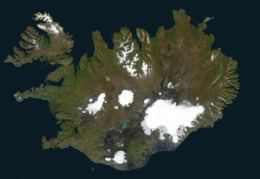
Iceland has extensive volcanic and geothermal activity. The rift associated with the Mid-Atlantic Ridge, which marks the division between the Eurasian Plate and North American tectonic plates, runs across Iceland from the southwest to the northeast. This geographic feature is prominent at the Þingvellir National Park, where the promontory creates an extraordinary natural amphitheatre. The site was the home of Iceland's parliament, the Alþing, which was first convened in 930. It is a common misconception that Þingvellir are at the juncture between the North American and Eurasian continental plates. However, they are in fact at the juncture of the North American continental plate and a smaller plate (approx. 10,000 km2) called the Hreppar Microplate (Hreppaflekinn).
About half of Iceland's land area, which is of recent volcanic origin, consists of a mountainous lava desert (highest elevation 2,110 m (6,923 ft) above sea level) and other wasteland. Around 10.2 per cent of the total land area is covered by glaciers, although these are now retreating at an accelerating rate. The four largest Icelandic glaciers are:
Other notable glaciers include:
Twenty per cent of the land is used for grazing, while only 1 per cent is cultivated. Iceland has lost most of the woodland that previously covered large areas of the country, but an ambitious reforestation programme is currently underway. Fossilized tree pollen and descriptions by the early settlers indicate that prior to human settlement, now thought to have occurred from around the year 800 onwards, trees covered between 30 and 40 per cent of the island. Today, however, there are only small patches of the original birch forests left, the most prominent being Hallormsstaðaskógur and Vaglaskógur.
The inhabited areas are on the coast, particularly in the southwest, while the central highlands are all but uninhabited.
Because of the Gulf Stream's moderating influence, the climate is characterized by damp, cool summers and relatively mild but windy winters. Reykjavík has an average temperature of 12 °C (53.6 °F) in July and 1 °C (34 °F) in January (Köppen: Cfc).
Statistics
Antipodes
Iceland is not antipodal to any land mass. The closest are the Balleny Islands off Antarctica, claimed by New Zealand. The antipodes of the northernmost of these, Young Island, lie between Flatey and Grímsey Islands off the north central Icelandic coast, about 10 km from either.
Geological activity
A geologically young land, Iceland is located on both the Iceland hotspot and the Mid-Atlantic Ridge, which runs right through it. This location means that the island is highly geologically active with many volcanoes, notably Hekla, Eldgjá, Herðubreið and Eldfell
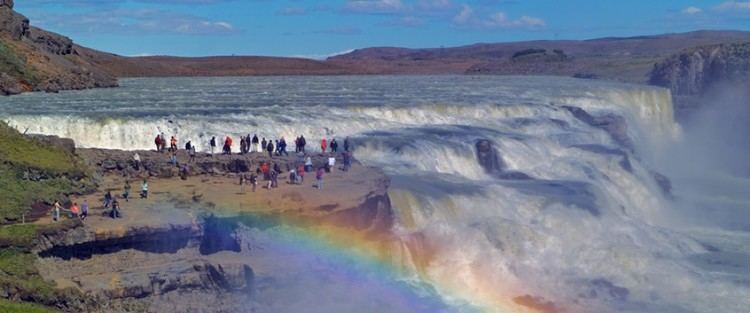
Iceland has many geysers, including Geysir, from which the English word geyser is derived.
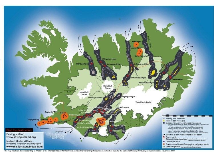
With the widespread availability of geothermal power, and the harnessing of many rivers and waterfalls for hydroelectricity, most residents have access to inexpensive hot water, heating and electricity. See geothermal power in Iceland.
The island is composed primarily of basalt, a low-silica lava associated with effusive volcanism as has occurred also in Hawaii. Iceland, however, has a variety of volcanic types (composite and fissure), many producing more evolved lavas such as rhyolite and andesite. Iceland has hundreds of volcanoes with approx. 30 volcanic systems active.