
Continent Africa Coastline 885 km (550 mi) | Area Ranked 77th | |
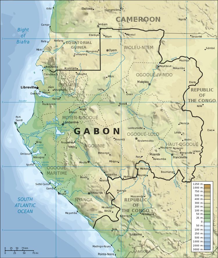 | ||
Highest point Mont Bengoué, 1070 m (not Mont Iboundji as claimed by some authorities) | ||
Gabon is a country in West Africa, lying along the Atlantic Ocean, just south of the Bight of Biafra.
Contents
Borders
Gabon has a total of 3,261 km of international boundaries. It borders Equatorial Guinea (335 km) and Cameroon (349 km) to the north and the Republic of the Congo (2,567 km) to the east and south. Gabon lies on the equator.
Climate
Gabon has the moist, hot climate typical of tropical regions. The hottest month is January, with an average high at Libreville of 31 °C and an average low of 23 °C. Average July temperatures in the capital range between 20 and 28 °C. From June to September there is virtually no rain but high humidity; there is occasional rain in December and January. During the remaining months, rainfall is heavy. The excessive rainfall is caused by the condensation of moist air resulting from the meeting, directly off the coast, of the cold Benguela Current from the south and the warm Guinea Current from the north. At Libreville, the average annual rainfall is more than 2540 mm. Farther north on the coast, it is 3810 mm.
Terrain
Narrow coastal plain with patches of Central African mangroves; hilly interior; savanna in east and south.
Environment
International agreements:
Party to: Biodiversity, Climate Change, Desertification, Endangered Species, Hazardous Wastes, Law of the Sea, Marine Dumping, Ozone Layer Protection, Ship Pollution, Tropical Timber 83, Tropical Timber 94, Wetlands, Whaling
Signed, but not ratified: None of the selected agreements