
 | ||
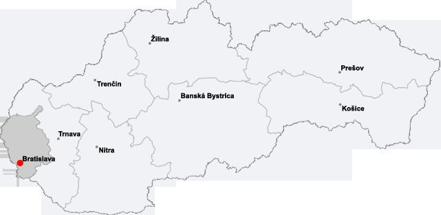
Bratislava, the capital city of Slovakia, is situated in the central Europe and in the south-west within Slovakia. Its location at the borders of Austria in the west and Hungary in the south makes it the only national capital in the world that borders two countries. It is only 62 kilometres (38.5 mi) from the border with the Czech Republic and only 60 kilometres (37.3 mi) from the Austrian capital Vienna.
Contents
The city has a total area of 367.58 square kilometres (141.9 mi²), making it the second largest city in Slovakia by area (after the township of Vysoké Tatry). Bratislava straddles both banks of the Danube River, which crosses the city from the west to the south-east. The Middle Danube basin begins at Devín Gate in western Bratislava. Other rivers nearby are the Morava River, which forms the north-western border of the city and flows into the Danube at Devín, the Little Danube, and the Vydrica, which flows into the Danube at the borough of Karlova Ves. Some parts of Bratislava, particularly Devín and Devínska Nová Ves, are vulnerable to floods. New flood protection is being built on both banks.
The Carpathian mountain range begins in city territory with the Little Carpathians (Malé Karpaty). The area includes Bratislava Forest Park, which is popular with many Bratislavans and is part of the Little Carpathians Protected Landscape Area. The city's lowest point is at the Danube's surface, at 126 metres (413.4 ft) above mean sea level, and the highest point is Devínska Kobyla at 514 metres (1686.3 ft). The average altitude is 140 metres (459.3 ft). The Záhorie and Danubian Lowlands are partly situated in the city.
The nearest towns and villages are: to the north Stupava, Borinka and Svätý Jur; to the east Ivanka pri Dunaji and Most pri Bratislave; to the south-east Rovinka, Dunajská Lužná and Šamorín; to the south Rajka (HU); and to the west Kittsee (AT), Hainburg an der Donau (AT) and Marchegg (AT).
Selected distances from certain European cities
Bratislava is situated: 62 km from Vienna; 196 km from Budapest; 324 km from Prague; 569 km from Belgrade; 769 km from Zürich; 1266 km from Paris; 1273 km from Amsterdam; 1314 km from Rome; 1473 km from Istanbul; 1602 km from London; 1735 km from Stockholm; 1886 km from Athens; 2104 km from Moscow and 2261 km from Madrid.
Climate
Bratislava lies in the north temperate zone and has a continental climate with four distinct seasons. It is often windy with a marked variation between hot summers and cold, humid winters. Recently, the transitions from winter to summer and summer to winter have been rapid, with short autumn and spring periods and the weather is occasionally extreme, quickly changing its state. Snow occurs less frequently now than previously.
Rivers and lakes in Bratislava
Twenty water streams originate in the area of Bratislava. Four rivers flow through the area of the city: Danube, Morava river, Little Danube and partially Malina.
In addition, 18 streams (Slovak: potok) and 9 canals (Slovak: kanál) or canalized streams flow through the city. The following is their list in alphabetical order: