
Country France INSEE/Postal code 92036 / 92230 Population 41,960 (2007) | Region Île-de-France Time zone CET (UTC+1) Area 11.63 km² Local time Sunday 1:26 AM | |
 | ||
Canton Chef-lieu of 2 cantons (Gennevilliers-Nord et Sud) Weather 8°C, Wind NW at 3 km/h, 78% Humidity | ||
Gennevilliers ([ʒənvilje]) is a commune in the northwestern suburbs of Paris, in the Hauts-de-Seine département of France. It is located 9.1 km (5.7 mi) from the center of Paris.
Contents
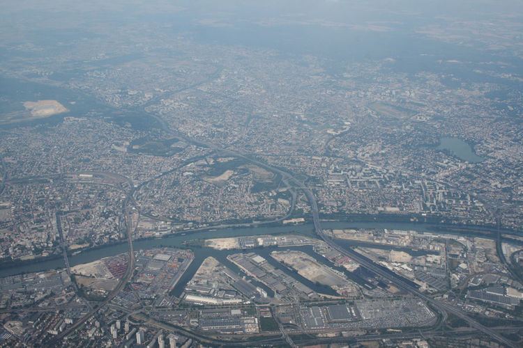
- Map of Gennevilliers France
- History
- Economy
- Transport
- Education
- Nativesresidents
- International relations
- References
Map of Gennevilliers, France
History
On 9 April 1929, one-fifth of the territory of Gennevilliers was detached and became the commune of Villeneuve-la-Garenne.
Economy
Gennevilliers is the site of the main river port Port of Gennevilliers of Paris on the Seine river.
Transport
Gennevilliers is served by three stations on Paris Métro line 13: Les Courtilles, Les Agnettes and Gabriel Péri. All three are at the border with the commune of Asnières-sur-Seine.
Gennevilliers is also served by two stations on Paris RER line C: Les Grésillons and Gennevilliers.
Education
Schools include:
There is a senior high school, Lycée Galilée.
Natives/residents
International relations
Gennevilliers is twinned with: