
Country France Time zone CET (UTC+1) Local time Monday 5:44 PM Population (2006)2 24,706 Area1 3.2 km2 (1.2 sq mi) | Region Île-de-France Canton Villeneuve-la-Garenne Area 3.2 km² INSEE/Postal code 92078 /92390 | |
 | ||
Weather 20°C, Wind N at 8 km/h, 35% Humidity | ||
Villeneuve-la-Garenne is a commune in the northern suburbs of Paris, France. It is located 9.2 km (5.7 mi) from the center of Paris in the Hauts-de-Seine department in the Île-de-France region.
Contents
- Map of 92390 Villeneuve la Garenne France
- History
- Transport
- Demographics
- Education
- Personalities
- References
Map of 92390 Villeneuve-la-Garenne, France
History
The commune of Villeneuve-la-Garenne was created on 9 April 1929 by detaching its territory from the commune of Gennevilliers.
Transport
Villeneuve-la-Garenne is served by no station of the Paris Métro, RER, or suburban rail network. The closest station to Villeneuve-la-Garenne is Saint-Denis station, which is an interchange station on Paris RER line D and on the Transilien Paris – Nord suburban rail line. This station is located in the commune of Saint-Denis, 0.9 km (0.56 mi) from the town center of Villeneuve-la-Garenne.
The town is well-served by the Paris metropolitan bus system : several lines run through its territory. (RATP bus lines 137, 177, 178, 261 and 378).
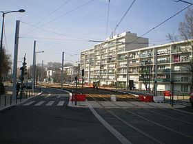
Since 15 November 2012, the city is being crossed by a tram (tram 1)
Demographics
As of January 1, 2011 there were 25,644 residents.
As of 2016 almost 37% of the residents are under 25 years of age.
Education
As of the 2015-2016 school year the commune had 1,280 preschool students, 1,973 elementary students, and 1,978 secondary students.
Junior high schools include:
Senior high schools:
The public library is the Bibliothèque Aimé-Césaire.