
Translation Seagull Peak (Spanish) Easiest route Hike Prominence 60 m | Topo map USGS Solvang Elevation 750 m | |
 | ||
Similar La Cumbre Peak, Figueroa Mountain, Boney Peak, Little Pine Mountain, Big Pine Mountain | ||
Gaviota Peak is a summit in the Santa Ynez Mountains in Santa Barbara County, California. It is located 10 miles (16 km) west of Santa Barbara, 16 miles (26 km) east of Point Conception and 2 miles (3.2 km) from the Pacific Ocean.
Map of Gaviota Peak, California 93117, USA
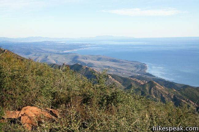
The Gaviota Peak Fire Road trail starts near the junction of U.S. Route 101 and California State Route 1, in Gaviota State Park, and ends on the summit in the Los Padres National Forest. The trail passes Gaviota Hot Springs, and offers views of the Santa Ynez Mountains, Lompoc Valley, the Pacific Ocean and the Channel Islands.
Gaviota Grade, is the most formidable in length and elevation change along U.S. Route 101 in Southern California.
References
Gaviota Peak Wikipedia(Text) CC BY-SA