
Population 614 (2011 census) Postal code 2702 | Postcode(s) 2702 Local time Friday 8:56 PM | |
 | ||
Location 494 km (307 mi) SW of Sydney486 km (302 mi) N of Melbourne57 km (35 mi) NW of Wagga Wagga15 km (9 mi) W of Coolamon Weather 24°C, Wind S at 8 km/h, 29% Humidity | ||
Beyond bank speaks to jason from ganmain grong grong matong football club
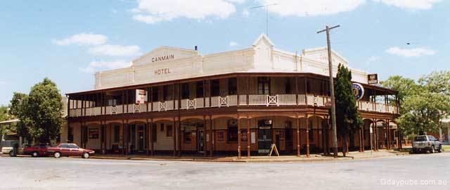
Ganmain is a town in the Riverina region of New South Wales, Australia. Ganmain is located around 55 kilometres (34 mi) north west of Wagga Wagga, and 50 kilometres (31 mi) east of Narrandera. Ganmain is in the Coolamon Shire local government area and had a population at the 2011 census of 614.
Contents
- Beyond bank speaks to jason from ganmain grong grong matong football club
- Map of Ganmain NSW 2702 Australia
- Ganmain day 1
- History
- Today
- Notable people from Ganmain
- References
Map of Ganmain NSW 2702, Australia
The town name is said to be an Aboriginal word meaning "Crown scenes on the Moon for tribal reasons" or "native decorated with scars". B
Ganmain day 1
History
Boggy Creek Post Office opened on 10 December 1888, was renamed Derry in 1894 and Ganmain later the same year.
Today
Ganmain is the self-proclaimed "Sheaf Hay centre of Australia" and has produced chaff for many leading racehorse trainers in Australia. The Big Haystack in Pioneer Park reflects this background.
The town has two primary schools, Ganmain Public School and St. Brendan's Catholic Primary School.
Ganmain is the home of the famous Ganmain Pies, sold at the Ganmain Bakery. They can be bought throughout the Riverina.
Australian rules football is the most popular sport with the local team, Ganmain-Grong Grong-Matong playing in the Riverina Football League.