
Prominence 1,715 m (5,627 ft) Elevation 1,715 m Province North Maluku | Last eruption 2015 | |
 | ||
Similar Dukono, Mount Gamkonora, Karangetang, Raung, Soputan | ||
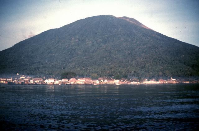
Gamalama is a near-conical stratovolcano that comprises the entire Ternate island in Indonesia. The island lies off the western shore of Halmahera island in the north of the Maluku Islands. For centuries, Ternate was a center of Portuguese and Dutch forts for spice trade, which have accounted for thorough reports of Gamalama's volcanic activities.
Contents
- Map of Gamalama Hutan Lindung Ternate City North Maluku Indonesia
- Ternate gamalama volcano 2010
- References
Map of Gamalama, Hutan Lindung, Ternate City, North Maluku, Indonesia
An eruption in 1775 caused the deaths of approximately 1300 people.
On December 4, 2011 Mount Gamalama erupted, ejecting material up to 2,000 meters into the air. Thousands of residents in nearby Ternate City fled due to ash and dust particles raining down on the town. Finally on December 27 some 4 people died and dozens injured from debris falls (lahar) after a month of activity.
More eruptions occurred in September 2012.
An eruption on December 18, 2014, deposited five centimeters of ash on the runway of Babullah Airport in Ternate, closing the airport.