
Vehicle registration WB Local time Thursday 8:30 PM | Time zone IST (UTC+5:30) | |
 | ||
Weather 26°C, Wind S at 10 km/h, 90% Humidity | ||
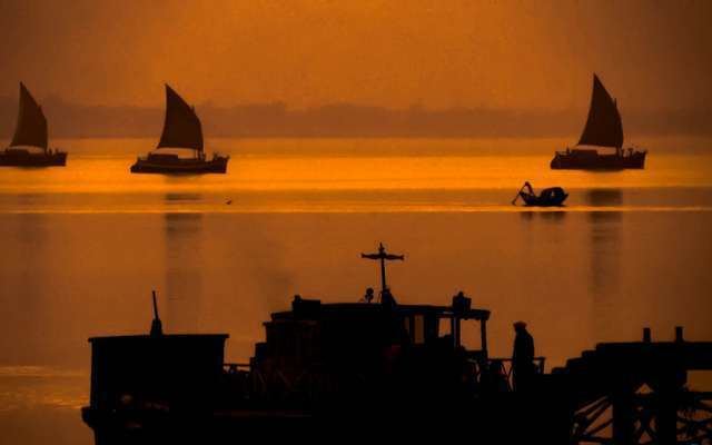
Gadiara is the point of convergence of rivers howrah west bengal india
Gadiara is a village in Howrah District of West Bengal, India. This place is the point of convergence of the Damodar, the Rupnarayan and the Hoogli rivers. Gadiara is a popular picnic and daytrip spot for locals and tourists alike.
Contents
- Gadiara is the point of convergence of rivers howrah west bengal india
- Map of Gadiara West Bengal 711314
- History
- CTC Bus
- Bus Routes without Numbers
- STA Bus
- Geography
- References
Map of Gadiara, West Bengal 711314
History
It is hardly 80–90 km from Calcutta and there are frequent bus services both private and state-owned (CSTC), from Esplanade, Kolkata. There is an old dilapidated fort, Fort Mornington, built by Lord Clive in Gadiara. The fort was heavily damaged during the devastating flood in 1942. There is a small lighthouse installed in Gadiara.
CTC Bus
Bus Routes without Numbers
STA Bus
Geography
Visitors can enjoy boating in the Rupnarayan river. Both sunrise and sunset in Gadiara are really worth seeing because of its vast waterfront resembling a sea. But, today, the calm and quietness of Gadiara is gradually disappearing and becoming congested. There are regular ferry services to the other side of the river i.e., to Geonkhali in Midnapore and to Nurpur in 24-Parganas.
Gadiara is located at 22.22°N 88.05°E / 22.22; 88.05.