Elevation 3,451 m Parent range Pennine Alps | Prominence 100 m Parent peak Furggen | |
 | ||
Similar Theodulhorn, Furggen, Unter Gabelhorn, Eastern Breithorn, Wellenkuppe | ||
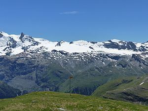
The Furgghorn (German, Italian: Cima del Breuil) is a mountain of the Pennine Alps, located on the boundary between the canton of Valais (Switzerland) and Aosta Valley (northern Italy). It lies on the range south-east of the Matterhorn, near the Theodul Pass. The closest locality is Breuil-Cervinia on the Italian side. The closest locality on the Swiss side is Zermatt.
Map of Furgghorn, 11028 Valtournenche, Aosta Valley, Italy
References
Furgghorn Wikipedia(Text) CC BY-SA
