
Adm. region Oberbayern Vehicle registration FS | Time zone CET (UTC+1) Website lra-freising.bayern.de | |
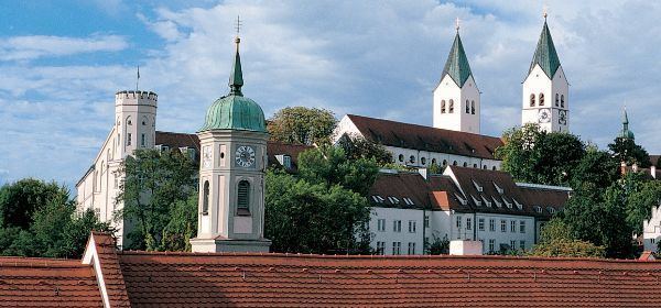 | ||
University Weihenstephan-Triesdorf University of Applied Sciences Points of interest Freising Cathedral, Weihenstephan Abbey, Stadtmuseum Freising, Altes Gefängnis, Mariensäule Destinations | ||
Freising is a district in Bavaria, Germany. Following a recent ranking of the German magazine FOCUS MONEY comparing all German districts it is number one concerning economic growth abilities. It is bounded by (from the north and clockwise) the districts of Kelheim, Landshut, Erding, Munich, Dachau and Pfaffenhofen. The district is located north of the Munich metropolitan area. The Isar and Amper rivers run in parallel from southwest to northeast. North of the rivers there is the Hallertau, a hilly region mainly used for hop growing.
Contents
Map of Freising, Germany
History
In the Holy Roman Empire, Freising was a clerical state ruled by the bishops. In 1803, when the clerical states of Germany were dissolved, the region was annexed by Bavaria.
The Freising Moor's head
This is a controversial charge in the Coat of Arms, which could represent one of many different persons:
Or just that a black Moor King.
It is important to note the crown on the moor's head, which probably indicated that the territory of the Bishop of Freising was autonomous.