Franz Tamayo is a province in the Bolivian department of La Paz. It lies in the western part of the nation, and includes the Ulla Ulla National Reserve - which today is part of the Apolobamba Integrated Management Natural Area - in the high Andean plain on the western border with Peru. Its capital is Apolo.
The province was founded with the name Caupollcán on January 23, 1826. On December 20, 1967 the name was changed in honor of the Bolivian intellectual, writer and politician Franz Tamayo (1878–1956).
The Apolobamba mountain range traverses the province. The highest mountain of the province is Chawpi Urqu (Wisk'achani) at 6,044 m (19,829 ft). Other mountains are listed below:
Franz Tamayo Province is divided into two municipalities which are further subdivided into nine cantons.
Some of the tourist attractions of the municipalities are:
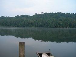
In Apolo Municipality:San Juan de Asariamas dry forest in Apolo Canton. The dominant trees species are the Bilka (Anadenanthera macrocarpa), the Cuchi (Astronium urundeuva), and the Brazilian Soto (Schinopsis brasiliensis).Machariapo River in Apolo Canton situated within Madidi National Park and Area of Integrated Managementthe Inca bridge in Santa Teresa community and the Chiara Alto waterfall of 18 m height in Apolo Cantonthe community of Pata, its old church and the Sillakunka tunnel in Pata Cantonthe valley of the community of Virgen del Rosario, also named Tuichi, in Pata Canton at the shores of Tuichi Riverthe community of Santa Cruz del Valle Ameno, the Billipiza waterfall of 22 m height in Vaquería and the archaeological site near Inca Viewpoint in Santa Cruz del Valle Ameno CantonTrinity festivity (Santísima Trinidad) in the community of Aténthe pre-Columbian trailsTuriapo River and its waterfall in the community of PucasuchoAyara waterfall of about 18 m height in the community of MunaypatacIn Pelechuco Municipality:Katantika, one of the most important peaks of the Apolobamba mountain range, about 5,592 m high, in Pelechuco Cantonthe colonial town of Pelechucothe village of Queara near Pelechuco which is also situated in the highest area of Madidi National Parkthe Ulla Ulla National Reserve in Ulla Ulla Canton, today a part of the Apolobamba Integrated Management Natural Areathe pre-Hispanic Guanan ruins in Pelechuco CantonCololo Lake in Antaquilla de Copacabana CantonSuches Lake on the border to PeruOther remarkable places are Pilón Lajas Biosphere Reserve and Communal Lands, Chalalan Lake and Chalalan ecolodge.