
Established 1999 Time zone ACST (UTC+9:30) Founded 1999 Federal division Division of Wakefield | Postcode(s) 5577 State electorate(s) Goyder Postal code 5577 | |
 | ||
Location 130 km (81 mi) west of Adelaide | ||
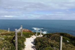
Foul Bay is a locality in the Australian state of South Australia located on the south coast of Yorke Peninsula immediately adjoining Investigator Strait about 130 kilometres (81 mi) west of the state capital of Adelaide.
Map of Foul Bay SA 5577, Australia
It was formally established in May 1999, with its name deriving from the Foul Bay Shack Site on South Coast Road. It also incorporates the pre-existing "Old Wheel Inn Shack Site" and the "Point Davenport Shack Site". A government town named "Nugent" was surveyed at the end of Nugent Road, near the Point Davenport site, in July 1880; however, it was never developed and was declared to have ceased to exist on 11 June 1925. In 2012, a portion of Foul Bay was added to Warooka.
As of 2014, the majority land use within the locality was “primary production.”
The 2011 census reported that Foul Bay shared a population of 241 people with the adjoining locality of Marion Bay.
Foul Bay is located within the federal division of Grey, the state electoral district of Goyder and the local government area of the Yorke Peninsula Council.