
- elevation 699 ft (213 m) Phone +1 612-279-3550 | Area 11.86 km² | |
 | ||
Address 101 Snelling Lake Road, St Paul, MN 55111, USA Hours Closed now Tuesday8AM–10PMWednesday8AM–10PMThursday8AM–10PMFriday8AM–10PMSaturday8AM–10PMSunday8AM–10PMMonday8AM–10PM | ||
A perfect summer day in fort snelling state park
Fort Snelling State Park is a state park of Minnesota, USA, at the confluence of the Mississippi and Minnesota rivers. Its most notable feature is the historic Fort Snelling, which dates from 1820. The fort itself is operated by the Minnesota Historical Society and requires a separate entrance fee. The bulk of the state park preserves the bottomland forest, rivers, and backwater lakes below the river bluffs. The park was opened in 1962. Both the State Park and Historic Fort are part of the Mississippi National River and Recreation Area, a National Park Service site.
Contents
- A perfect summer day in fort snelling state park
- Fort snelling state park ride
- LandscapeEdit
- HistoryEdit
- RecreationEdit
- References
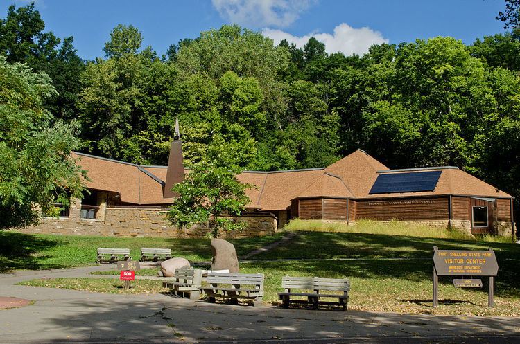
As of 2005, the park hosts 400,000 visitors annually and contains the restored fort, a visitor center, 18 miles (29 km) of cross-country skiing trails, 18 miles (29 km) of hiking trails, and 5 miles (8.0 km) of biking trails. These trails connect the park to the Minnesota Valley National Wildlife Refuge, Minnehaha Park, and regional trail systems like the Grand Rounds Scenic Byway and the Big Rivers Regional Trail. Minnesota State Highway 55 crosses over the park on the Mendota Bridge, and many jets taking off and landing at the Minneapolis–Saint Paul International Airport fly directly over the park.
Fort snelling state park ride
LandscapeEdit
Today the bottomlands of the river confluence boast a floodplain forest of cottonwood, silver maple, green ash, wood nettle, jewelweed, and willow. There are also marshes, backwater lakes, and wet meadows. Abundant wildlife includes white-tailed deer, fox, woodchuck, badger, skunk, turkey, and coyote. Reptiles include the snapping turtle, painted turtle, soft-shelled turtle, and the non-venomous western fox snake. In 1864 a railroad was built through the area, connecting St. Paul with the riverboat landing.
HistoryEdit
At the beginning of historical times, Mdewakanton Dakota lived in this area. The confluence of the Mississippi and Minnesota rivers was to them the center of the world. In 1805 Lieutenant Zebulon Pike met with the Mdewakanton on the island between the two rivers and negotiated the purchase of land along the blufftops. The treaty site is now known as Pike Island. Details of Fort Snelling, which was built between 1820 and 1825 on the land Pike acquired, are contained in its own entry.
The soldiers from Fort Snelling had gardens, livestock, bakery, and boat storage sheds in the low river valley. After the Dakota War of 1862, over 1600 Dakota men, women, and children were forcibly confined in a camp in this area through the winter of 1862–1863, before being expelled to Nebraska. Over the winter, approximately 300 died due to malnutrition, disease, and exposure.
During the 1950s, the state government had planned to build a freeway interchange and bridge over the site of the fort, prompting concerned locals and Russell W. Fridley, director of the Minnesota Historical Society, to call a meeting to examine how to preserve the fort. Eventually, the state agreed to build a tunnel underneath the fort, thus preserving the old structures. In 1960, A.R. Nichols, a landscape architect, submitted plans for a 2,400-acre (9.7 km2) park on the site. Based on a much earlier plan, this design would become the basis for the final form of the park. This caught the interest of Thomas C. Savage who wrote State Parks director U.W. Hella. Hella urged Savage to form an association of interested citizens which became the Fort Snelling State Park Association, putting money and public relations effort into the promotion of the park's establishment. While there was widespread support for preserving the old fortifications, some local landowners were not enthused about plans to purchase additional lands, claiming that the price the government proposed to pay was not adequate. In response, the Park Association began to raise funds privately to buy out at least some of the owners. A second consideration was whether or not the federal government would grant the actual fort property to the state as surplus land.
On the last day of the 1961 legislative session, a $65,000 appropriation was made and the park's boundaries were set (on a much smaller scale than can be seen today) so as to acquire the federal land. On October 29, the federal government donated 320 acres (1.3 km2) of land, including portions of the fort, to the State of Minnesota under the 1944 Surplus Property Act. The park was officially opened on June 3, 1962.
The restoration of the fort had begun as early as 1957, and with the establishment of the park, such efforts received new momentum. Old plans were found in the National Archives and the state legislature granted regular appropriations to fund the project until 1979. Limestone to match the original building material was taken from lands owned by the City of Saint Paul and the Webb Publishing Company. Eventually, the remaining half of the fort, which had been occupied by the Department of Veterans Affairs was also donated to the park and restoration of the entire fort could proceed. Structures including walls, the round tower, barracks, the commandant's house, gatehouse, magazine, school, and others were either restored or rebuilt to 19th-century condition. Workers went so far as to recreate the rough trowel tuckpointing of the original stone blocks. Controversially, WPA murals from the 1930s were removed from the interior of the tower.
In 1970 a swimming beach was opened in the park and visitation increased 75%. An interpretive center was opened in 1974, the first year-round interpretive center in the Minnesota state park system. Even without a campground, this is the most visited state park in Minnesota most years.