
Prominence 388 m | Elevation 2,611 m | |
 | ||
Similar Piz Sardona, Magerrain, Piz Segnas, Mürtschenstock, Tödi | ||
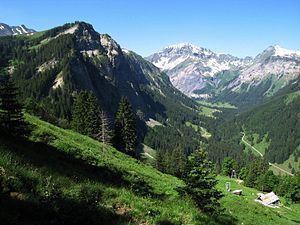
The Foostock, also known as the Ruchen, is a mountain of the Glarus Alps, located on the border between the Swiss cantons of Glarus and St. Gallen. It lies north of Piz Sardona, on the range that separates the Sernftal from the Weisstannental.
Map of Foostock, 7326 Mels, Switzerland
The Foostock lies between two passes that carry hiking trails between the cantons of St. Gallen and Glarus. The Foo Pass lies to the south of the Foostock and carries a trail from Weisstannen in St. Gallen to Elm in Glarus, forming part of the Alpine Pass Route between Sargans to Montreux. The less well known Riseten Pass lies to the north of the Foostock and links Weisstannen with Matt in Glarus.
References
Foostock Wikipedia(Text) CC BY-SA