
Traversed by Trail | Elevation 2,223 m | |
 | ||
Location | ||
Sardona ultra trail 14 09 2013 foo pass verlaufen
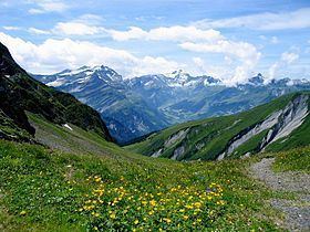
The Foo Pass (German: Foopass) is a mountain pass of the Glarus Alps, located on the border between the Swiss cantons of St. Gallen and Glarus, at an elevation of 2,223 m (7,293 ft). It crosses the col between the peaks of Foostock and Piz Sardona.
Contents
- Sardona ultra trail 14 09 2013 foo pass verlaufen
- Map of Foopass 7326 Glarus SC3BCd Switzerland
- References
Map of Foopass, 7326 Glarus S%C3%BCd, Switzerland
The pass is traversed by a trail, which connects the village of Weisstannen, in the canton of St. Gallen at an elevation of 1,004 m (3,294 ft), with the village of Elm, in the canton of Glarus at an elevation of 977 m (3,205 ft). The trail forms part of the Alpine Pass Route, a long-distance hiking trail across Switzerland between Sargans and Montreux.
The alpine pasture below the pass on the St Gallen side is notable for its marmot colony.
References
Foo Pass Wikipedia(Text) CC BY-SA