
Area 24.39 km² | Canton Feurs Population (1999) 7,669 Local time Saturday 6:41 AM | |
 | ||
Weather 3°C, Wind SE at 3 km/h, 83% Humidity | ||
Feurs is a commune in the Loire department and in the Auvergne-Rhône-Alpes region in central France.
Contents
- Map of 42110 Feurs France
- Antiquity
- Middle Ages
- Early modern age
- French Revolution
- Geography
- Economy
- Leisure
- Mayors
- Population
- Landmarks
- Twin towns
- Notable residents
- References
Map of 42110 Feurs, France
The inhabitants of Feurs are called Foréziens.
Antiquity
The city was founded by the Romans. The name Feurs is a contraction of Segusiavorum Forum. With a forum the Gallo-Roman era, city was the capital of Ségusiaves as is indicated by Ptolemy and appears on the Tabula Peutingeriana. By extension, the city gave its name to Forez.
Vestiges of the ancient Roman city are located by the current post office. Archaeologists have unearthed a theater, sewers, milestones, inscriptions, statuettes and pottery that reflect the importance, at that time, of the Roman the town, located near important Roman roads.
Middle Ages
A church dedicated to St. Baudile is reported in 960. A second dedicated to the Virgin Mary appears in the texts in 1001. A Castle in Feurs is reported in 1246. In the Middle Ages, the city had no bridge over the Loire but there was a harbor(953) and another close to Randans (1060).
Early modern age
Feurs with the Forez County is forfeited to the Constable of Bourbon along with his other possessions in 1523. It finally enters the royal domain in 1531. In 1542, the city is attached to the generality of Lyon, created by Henry II .
French Revolution
The French Revolution was very active in the town and the horrors of the guillotine marked its inhabitants.During the Revolution, the Revolutionary Court headed by Claude Javogues made many victims. The 80 victims of the Revolutionary Court were almost all executed at the site of the Chapel of the Martyrs. The chapel of the martyrs was erected later by Mayor Pierre-Marie Assier in 1826. It was for a short time capital of the Loire department in 1793-1795.
The town was on one of the first railways: line 3 of France Andrezieux - Roanne opened 1 August 1832 between Saint-Bonnet-les-Oules and Balbigny. This is in Feurs that from this section that are installed the workshops of the company that will build more locomotives under the orders of Régnié engineer.
The sites of archaeological interest are many but all are discovered during the various works in the municipality.
The city gave its name to the Forez province in which it is located.
Feurs was the capital of the Loire department from 1793 to 1795, during the French Revolution.
Geography
The river Lignon du Forez flows into the Loire in the commune.
Feurs is located in the Forez plain, between the Monts du Lyonnais to the East and the Monts du Forez to the West.
Economy
Over 300 small and medium enterprises are settled in Feurs and account for about 3'200 jobs, distributed as follows: tertiary sector (1675), metal industry (1280), construction (267).
Leisure
The city offers an Olympic size swimming pool and horse racetracks, as well as playing fields for soccer, rugby and basketball.
Inhabitant from Feurs can also easily access hiking trails towards the "Monts du Forez" or "Monts du Lyonnais".
Mayors
Population
In 2013, the municipality had 7,937 inhabitants. The evolution of the number of inhabitants is known through the population censuses carried out in the town since 1793. From the twenty-first century, actual censuses of towns under 10,000 inhabitants are held every five years, unlike other cities that have a sample survey every year.
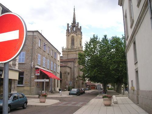
Landmarks
Twin towns
Feurs and the town of Olching in Bavaria, Germany, have been twin towns since August 1963, when a delegation of 24 Foréziens, led by the mayor Félix Nigay, visited their German counterparts for the first time.