
Max. width 9 kilometres (5.6 mi) Surface elevation 662 m Length 60 km Volume 6 km³ | Max. length 60 kilometres (37 mi) Max. depth 130 metres (430 ft) Area 203.5 km² Width 9 km Shore length 234.9 km | |
 | ||
Surface area 203.52 km (78.58 sq mi) | ||
Bushcraft camping expedition clif bar 10 day trip into femundsmarka national park norway
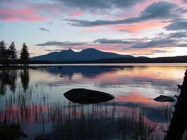
Femunden is Norway's third largest lake and the second largest natural lake in Norway. It is located close to the border with Sweden in the municipalities of Os, and Engerdal in Hedmark county and Røros in Sør-Trøndelag county. Femundsmarka National Park borders the northeastern part of the lake.
Contents
- Bushcraft camping expedition clif bar 10 day trip into femundsmarka national park norway
- Map of Femund Norway
- Kayaktrip s len and femunden in norway
- Name
- History
- References
Map of Femund, Norway
The 204-square-kilometre (79 sq mi) lake holds about 6 cubic kilometres (1.4 cu mi) of water and reaches a maximum depth of 130 metres (430 ft). The surface of the lake sits about 662 metres (2,172 ft) above sea level.
Kayaktrip s len and femunden in norway
Name
The first element (Fe- or Fem-) has no known meaning, and the last element is the suffix -mund or -und (both are common in Norwegian place names).
History
After Sweden had conquered the parishes of Idre and Särna in 1644 lake Femunden was considered to be part of the border between Norway and Sweden. But this was never officially recognised by Norway (or in reality by the Danish government, since Norway was ruled from Copenhagen in the early modern age), and during border adjustments in 1751 the Femundsmarka east of the lake was granted to Norway from Sweden. The new (and current) border from 1751 is quite special: For a length of 61 kilometers (nearly 40 miles) it makes a completely straight line between the summits of Våndsjögusten (1002 meter) and Østerhogna (1185 meter), straight-line national borders being very unusual in Scandinavia except in the very northernmost parts.