
Country Region | Area 4,358.45 km2 | |
 | ||
Colleges and Universities College of Dunaujvaros, Kodolanyi Janos University College Destinations Szekesfehervar, Dunaujvaros, Sarbogard, Gardony, Bicske | ||
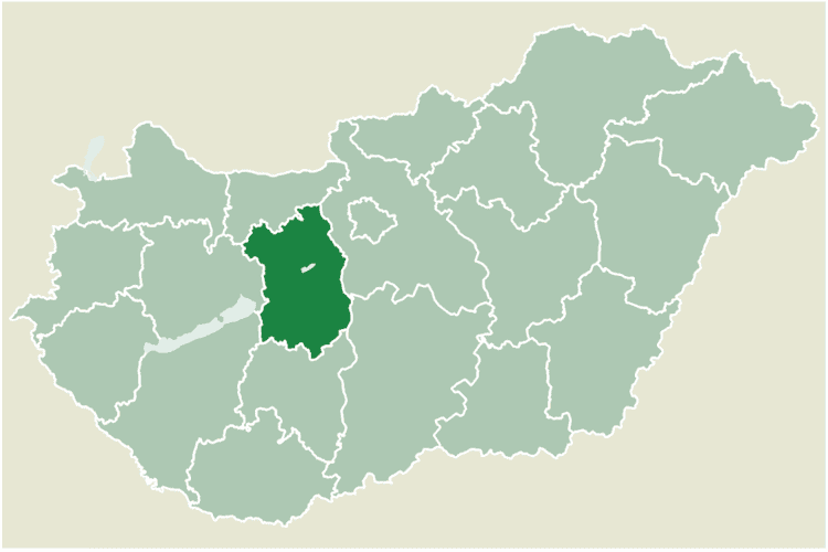
Fejér ([ˈfɛjeːr]) is an administrative county (comitatus or megye) in Central Hungary. It lies on the west bank of the river Danube and nearly touches the eastern shore of Lake Balaton. It shares borders with the Hungarian counties Veszprém, Komárom-Esztergom, Pest, Bács-Kiskun, Tolna and Somogy. The capital of Fejér county is Székesfehérvár.
Contents
- Map of Fejr County
- Geography
- Before the Conquest
- From the Conquest until the Ottoman occupation
- Fejr under Ottoman rule
- Demographics
- Ethnicity
- Religion
- Politics
- Cities with county rights
- Towns
- Villages
- References
Map of Fejér-County
Geography
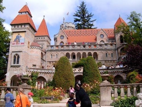
Geographically, Fejér County is very diverse; its southern part is similar (and adjacent) to the Great Hungarian Plain, and other parts are hilly (Bakony, Vértes, Gerecse mountains). Lake Velence, a popular resort, is also located there.
Before the Conquest
The area was already inhabited 20,000 years ago. When this part of Hungary formed a Roman province called Pannonia, several settlements stood here: the capital was Gorsium, but there were other significant towns too, where present-day Baracs and Dunaújváros are (the towns were called Annamatia and Intercisa, respectively). In the early Medieval period Huns and Avars lived in the area. After 586 several nomadic people inhabited in the area, until Hungarians conquered it in the late 9th century.
From the Conquest until the Ottoman occupation
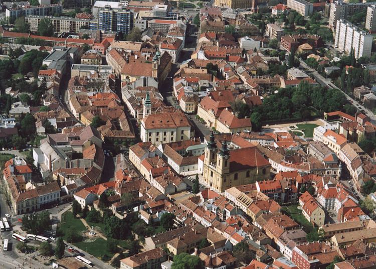
Hungarians arrived in the area between 895 and 900. The high prince and his tribe settled down in this area. The town of Fehérvár (modern-day Székesfehérvár) became significant as the seat of Prince Géza. Under the reign of his son, King Stephen, the town became the county seat of the newly formed county. Kings of Hungary were crowned and buried in the town until the 16th century.
Fejér under Ottoman rule
Fejér county was occupied by Ottomans between 1543 and 1688. Several of the villages were destroyed, the population dramatically decreased. After being freed from Ottoman rule, local administration was reorganized in 1692. Székesfehérvár got back its town status only in 1703.
Demographics
In 2015, it had a population of 417,651 and the population density was 96/km².
Ethnicity
Besides the Hungarian majority, the main minorities are the Roma (approx. 6,500), Germans (5,500).
Total population (2011 census): 425,847
Ethnic groups (2011 census): Identified themselves: 372 538 persons:
Approx. 65,000 persons in Fejér County did not declare their ethnic group at the 2011 census.
Religion
Religious adherence in the county according to 2011 census:
Politics
The Fejér County Council, elected at the 2014 local government elections, is made up of 20 counselors, with the following party composition:
Cities with county rights
Towns
(ordered by population, as of 2011 census)
Villages
municipalities are large villages.