
Time zone BST (UTC+6) | ||
 | ||
Faridpur district
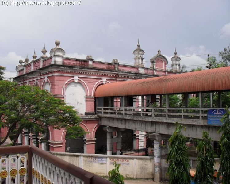
Faridpur (Bengali: ফরিদপুর জেলা) is a District in south-central Bangladesh. It is a part of the Dhaka Division. It is bounded by the Padma River to its northeast. The district is named after the municipality of Faridpur. Historically, the town was known as Fathabad. It was also called Haveli Mahal Fathabad. Despite its importance in agriculture and transport, Faridpur remains one of Bangladesh's relatively poor districts. It was a railway and shipping center under British rule in Bengal. The district is notable for its medieval and colonial architecture.
Contents
- Faridpur district
- Map of Faridpur District Bangladesh
- Kobi jashimuddin s house in faridpur district 2013
- History
- Geography
- Polities and local government
- List of upazilas
- Demographics
- Economy
- Culture and sport
- Education
- References
Map of Faridpur District, Bangladesh
Kobi jashimuddin s house in faridpur district 2013
History
The town of Fathabad was located by a stream known as the Dead Padma, which was 20 miles from the main channel of the Padma River. Sultan Jalaluddin Muhammad Shah established a mint in Fathabad during his reign in the early 15th century. Fathabad continued to be a mint town of the Bengal Sultanate until 1538. In Ain-i-Akbari, it was named as Haweli Mahal Fathabad during the reign of Emperor Akbar in the Mughal Empire. The Portuguese cartographer João de Barros mentioned it as Fatiabas. The Dutch map of Van den Brouck described it as Fathur.
Its first mention in Bengali literature was by Daulat Uzir Bahram Khan in his adaption of Layla and Majnun. The medieval poet Alaol was born in Faridpur.
Fathabad was a strategically important base in south and southwestern Bengal. It was a well-developed urban center. The town was home to important Mughal government officials, including generals, civil servants and jagirdars. During the reign of Emperor Jahangir in the 17th century, local zamindars Satrajit and Mukund resisted the Mughal government. By the 19th century, the town was renamed as Faridpur in honor of the Sufi saint Shah Fariduddin Masud, a follower of the Chishti order of Ajmer. Haji Shariatullah led the conservative Faraizi movement in Faridpur during the early 19th century.
The Faridpur District was established by the British in 1815. The Faridpur Subdivision was a part of Dacca Division in the Bengal Presidency established by the East India Company. The municipality of Faridpur was established in 1869. The subdivision covered modern day Faridpur, Rajbari, Madaripur, Shariatpur and Gopalganj District, Bangladesh districts (collectively known as Greater Faridpur). It was included in Eastern Bengal and Assam during the British Raj between 1905 and 1912.
Faridpur was a rail] terminus for the Bengal Provincial Railway and the Eastern Bengal Railway, connecting Calcutta with the important Goalanda ghats, from where ships traveled to Colonial Assam and British Burma. British Faridpur was the birthplace of several nationalist leaders of the subcontinent, including Ambica Charan Mazumdar, Humayun Kabir, Maulvi Tamizuddin Khan and Sheikh Mujibur Rahman. The acclaimed American engineer F R Khan was also born in the region.
Faridpur saw intense fighting during the Bangladesh Liberation War in 1971. It was one of original 18 subdivisions of Bangladesh at the time of independence. In 1984, the devolution reforms of President Hussain Muhammad Ershad divided the old subdivision into five districts. In 2015, the Government of Bangladesh announced plans to establish a Faridpur Division.
Geography
The Faridpur District has an area of 2072.72 sq km, located in between 23°17' and 23°40' north latitudes and in between 89°29' and 90°11' east longitudes. It has land borders with Rajbari, Gopalganj, Madaripur and Shariatpur districts, as well as riverine borders with Dhaka, Manikganj and Munshiganj districts in the Padma River, which forms northeastern boundary. The main rivers and water bodies are the Padma, Old Kumar, Arial Khan, Gorai, Dhol Samudra, Ramkeli, Ghoradar and Shakuner Beel. The fauna of the region includes domesticated animals such as cows, horses, sheep, goats and buffalo. Wildlife includes foxes, wild boar and pythons. In terms of flora, rice paddies cover 45% of the gross temporary cropped area. The district has a flat plain land landscape with vast homestead forests, including trees such as jackfruit, betel nut, coconut and date palm. The low-lying southern area has dense homestead forests.
Polities and local government
The district has 9 upazilas, 4 municipalities, 36 wards, 100 mahallahs, 79 unions and 1,899 villages. The district has four parliamentary constituencies in the Jatiyo Sangshad. The Faridpur District Council is the highest tier of local government.
List of upazilas
Below is a list of the district's 9 upazilas:
- Alfadanga Upazila
- Bhanga Upazila
- Boalmari Upazila
- Charbhadrasan Upazila
- Faridpur Sadar Upazila
- Madhukhali Upazila
- Nagarkanda Upazila
- Sadarpur Upazila
- Saltha Upazila
Demographics
According to the 2011 Bangladesh census, Faridpur District had a population of 1.9 million. While Bengali Muslims make up the overwhelming majority (1.7 million), the district has a significant minority of Bengali Hindus (180,000). In 2011 there were 4016 mosques and 893 temples.
Economy
Faridpur is an important center of the jute trade and hilsa fish trade. Its industrial sector features numerous jute mills, sugar mills and a 50 MW thermal power plant. The under-construction Padma Bridge is predicted to drastically boost economic activities in Faridpur District.
In terms of transport, Faridpur is an important hub of the Bangladesh Railway, with its tracks connected to the Indian Railway in West Bengal. It is linked by road with Kushtia, Meherpur, Khulna, Barisal, and Jessore. Ferries and shipping are among the most widely used forms of inter-district transport by people and businesses in Faridpur District.
57% of land holdings in Faridpur District are farms. The main crops are jute and rice. Other crops include peanut, wheat, oilseed, pulse, turmeric, onion, garlic and coriander. Cinnamon spices are produced by some farms. Many fruits are also produced, notably mango, jack fruit, blackberry, date palm, coconut, betel nut, papaya, banana, and guava. The main exports are jute, hilsa fish and sugarcane. The poultry and dairy industries include over 1000 farms in each sector. Fishing is a major occupation for many inhabitants. Wholesale and retail outlets are the largest tertiary sector. There are 228 bazaars. The leading industrial operations in the private sector include Aziz Pipes, Karim Jute Mills, Faridpur Sugar Mills, Nur Plastics and BS Jute Mills.
Culture and sport
Faridpur District has a rich heritage of folk music, including Baul, Marami, Bichar, Murshidi-Marfati, Fakirali, Gazirgan, Kabigan, Jarigan music. However many of these traditions are extinct. Major festivals include Eid, Nabanna, Pous Utshab, Rathjatra, Dol Purnima Utshab and Durga Puja. Folk festivities are held on the occasion of Annaprashana, Muharram, Bengali weddings, Jamai Shasthi, Bhadra Mangal Chandi. Folk games of the district include Dariabandha, boat racing, Ha-du-du and cock fighting. Cricket and football are the most popular sports.
Faridpur was the home of the pastoral poet Jasimuddin. An annual Jasim Fair is held annually in his memory.
Major contemporary and historical publications include Jagaran, Ganaman (1370 BS), Chashi Barta, Idaning, Thikana, Bhorer Runner, Faridpur (1997), Kumar (2006); Weekly: Kalbhabna (2004), Pragotir Din (1995), Boalmari Sangbad, Al Helal, Bhanga Khabar; Fortnightly: Nazir Bangla Defunct: Faridpur Darpan (1861), Chitrakar (1283 BS), Kohinoor (1896), Sanjay (1900),' Aryakayastha (1318 BS), Faridpur Hitoishi (1329 BS), Faridpur Angina (1329 BS), Barta (1926), Muazzen (1335 BS), The Servant of Humanity (1960), Siraj (1932), Langal (1932), Sheba (1350 BS), Khedmat (1373 BS), Jubashakti (1972), Weekly Bangladesh (1972), Satyajug (1975), Faridpur Barta (1979), Aakal (1979), Samachar (1980) and Bangla Sangbad (1982).
Education
There are several state owned colleges in the district. Several venerable British Raj-era educational institutions are located in the region, including the Rajendra Collge (1918), Faridpur District School (1840), George Academy (1911), Bakiganj Islamia Madrasa (1922), Hitoishi High School (1889), Bhanga Pilot High School (1889), Karakdi Rambihari Multilateral High School (1901) and Krishnapur High School (1910). The Faridpur Medical College was established in 1985.