
Changed Municipality 1998 Toronto from York Community York | ||
 | ||
Restaurants Sushi Zuki, Sky Ranch Restaurant, Toben Food By Design Inc, Taste of Shawarma, Thai Shan Inn | ||
Fairbank is a neighbourhood in Toronto, Ontario, Canada. The area covers a large central portion of the former City of York, Ontario centered on the intersection of Dufferin Street and Eglinton Avenue West. Fairbank includes the neighbourhoods of Briar Hill–Belgravia (North of Eglinton Avenue West) and Caledonia–Fairbank (South of Eglinton Avenue West). The western border is the CNR lines. The northern and southern borders are the former borders of the City of York and the eastern border is Dufferin Street (Oakwood–Vaughan).
Contents
- Map of Fairbank Toronto ON Canada
- History
- Character
- Districts
- Transportation
- Landmarks
- Education
- Demographics
- References
Map of Fairbank, Toronto, ON, Canada
History
The area began at the Fairbank Postal Village at the intersection of Vaughan Road (an early settler's street crossing though farmland on the way to Vaughan Township) at Eglinton and Dufferin Street. The postal village name was derived from the Fairbank Farm owned by English settler Matthew Parsons (and named by his father-in-law Jacob Mackay).
St Hilda's Anglican church (St. Hilda's Retirement Residence, added in 1975) was built at the Fairbank intersection, although a cul-de-sac was later created at the northern end of Vaughan Road to simplify the Eglinton and Dufferin intersection when Eglinton Avenue began to develop as a commercial street with many mid-rise apartment buildings.
Character
The neighbourhood has many rolling hills and steep, climbing streets. To the west, Prospect Cemetery separates Fairbank from development along the railway. Most of the neighbourhood as it exists today was planned in the interwar years (1920s & 1930s) with mostly small single family 2 and 1½ storey detached homes on north-south residential streets. Eglinton Ave. is organized into two BIAs: Fairbank Village and York-Eglinton. St. Clair Avenue to the south is organized into two BIAs: 'Corso Italia' and 'St. Clair Gardens'. The neighbour historically acts an extension of Corso Italia - having a heavy Italian influence, however is now heavily influenced and inhabited by Portuguese immigrants.
Districts
This neighbourhood contains several named areas.
Transportation
The Toronto Transit Commission bus routes that serve this neighbourhood include the 29 Dufferin, 32 Eglinton West, 47 Lansdowne (along Caledonia Road), and the 109 Ranee (along Marlee Avenue) during regular hours, and for night service, 307 Eglinton West and 329 Dufferin. Though there are no subway stations within the neighbourhood, they are within walking distance from its boundary; the two nearest stations are Glencairn station and Eglinton West station. The upcoming Crosstown-Metrolinx LRT route will provide quick service along Eglinton Avenue once complete.
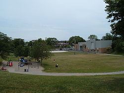
Landmarks
Education
The Toronto District School Board operates public anglophone secular schools. The Toronto Catholic District School Board operates public anglophone Catholic schools. The Conseil scolaire Viamonde operates public secular Francophone schools serving the area. The Conseil scolaire de district catholique Centre-Sud operates public Catholic Francophone schools serving the area.
Demographics
According to the 2006 census, the majority of the neighbourhood's population is Roman Catholic (over 65%), and there are a large number of people who speak Portuguese and Italian, with many recognizable ethnic influences in the neighbourhood. As of the 2011 National Household survey, the population was divided into 37% Portuguese, 6% Italian, 2% Spanish, with the remaining 55% being of other Southern European origins, compared to the 75% of Portuguese reported in the 2006 census. The neighbourhood is inhabited mostly by first generation Canadians (76%).