
Population 8,006 (2011.ward) Sovereign state United Kingdom Local time Friday 5:35 PM | OS grid reference SP353856 Post town COVENTRY Dialling code 024 | |
 | ||
Weather 11°C, Wind S at 8 km/h, 87% Humidity | ||
Exhall is a suburban settlement in the Nuneaton and Bedworth district of Warwickshire, England.
Contents
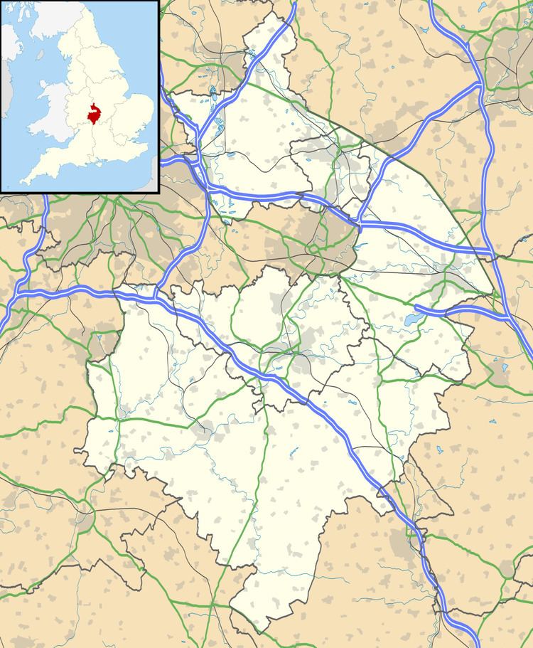
Map of Exhall, UK
Geography
Exhall is an area south of Bedworth located 4.3 miles (7 km) north-north-east of Coventry and 3.8 miles (6.1 km) south of Nuneaton. The population of the ward taken at the 2011 census was 8,006. It is bounded (approximately) by a disused mineral railway (that used to serve Newdigate Colliery) to the north, the Coventry–Nuneaton railway line to the east, Pickards Way (B4113 spur) and the M6 to the south, and Church Lane/Bowling Green Lane and the River Sowe to the west. The area makes up the eastern part of the ecclesiastical parish of Exhall St Giles. However, the parish church of St Giles is located on the north-eastern edge of nearby Ash Green (which forms the western part of the parish).
The River Sowe and the Coventry Canal are the principal waterways in the area.
History
Historically, the parish of Exhall (which extends from Black Bank in Bedworth to the north of Holbrooks in Coventry) had no clear centre, instead being composed of a number of hamlets, such as Black Bank, Hayes Green, Exhall Hall Green, Wagon Overthrow, Little Bayton, Ash Green, Neal's Green and Newland.
Although Exhall is not mentioned specifically in the Domesday Book, it would have probably formed part of lands owned by Lady Godiva in Ansty and Foleshill. In any case, the parish was probably inhabited from at least the 13th century, as the nave and chancel of St Giles's church appear to date from this period, with the tower added in the 14th century.
Although the area remained largely rural until recent times, coal mines were attested from the early 17th century onwards. During the Industrial Revolution, activities such as coal-mining and brick-making were further developed, leading to an increase in the population of the parish, and consequently the construction of many small houses for workers. These were mainly located along what is now Black Bank/Coventry Road Exhall, in Ash Green and in Goodyers End in Bedworth (part of which is included in the parish of Exhall). In 1868, the main industry in the parish – in common with towns such as Nuneaton and Coventry – was ribbon-making. Saunders Manor was located on the outskirts of Exhall (on the site near Springfield Crescent) before being demolished.
From the 1930s onwards, Exhall became more residential in character, with the construction of numerous housing estates, both social (e.g. the Armson Road/Grant Road estate at Hayes Green) and private (e.g. the Cedars Estate).
On 19 February 1949 two aircraft collided at 4500 ft near Exhall. The wreckage fell near an old people's home, the Exhall Lodge Hospital. There were no survivors.
In the 1960s, a large industrial estate was created in the east of Exhall, bordering the Coventry–Nuneaton rail line, at Bayton Road. Other industrial areas were subsequently developed at Black Horse Road and Grovelands (off Longford Road).
Today, the name Exhall applies principally to the area immediately south of Bedworth (centred on Black Bank and Coventry Road Exhall), with Ash Green retaining a somewhat separate identity – a fact accentuated by the construction of the Bedworth Bypass (A444) in 1970 and the final section of the M6 motorway in 1971. Even today, Ash Green remains more rural than Exhall, with a number of farms still in operation (e.g. Exhall House Farm, Grange Farm, Newland Hall Farm, Barker's Farm).
Both Exhall and Ash Green form part of the Coventry/Bedworth Urban Area, the conurbation that includes Coventry and Bedworth, and as such are in many respects suburbs of Coventry, as reflected by their inclusion in the Coventry post town.
Local government
From 1451 to 1842, Exhall was a parish in the Liberty of Coventry, which was geographically in the hundred of Knightlow in the county of Warwickshire, but administratively separate.
Following the abolition of the Liberty of Coventry, the city boundary was revised, with Exhall excluded.
With the passing of the Local Government Act 1894, which established urban and rural districts in England and Wales, Exhall formed part of the Foleshill rural district, up until the creation of the Bedworth urban district in 1928, to which it was transferred. Following local government reorganisation in 1974, Bedworth urban district was merged with Nuneaton municipal borough to form the new borough of Nuneaton (renamed Nuneaton & Bedworth in 1980).
For electoral purposes, Exhall is split (at both borough and county level) along Black Bank/Coventry Road Exhall/Longford Road.
At borough level, western Exhall is covered by Exhall ward (together with Ash Green and Keresley End), while western Exhall is covered by Poplar ward (together with Coalpit Field and the southern part of Furnace Fields). Each ward is represented by two borough councillors, who are elected for a four-year term by halves.
At county level, western Exhall is covered by the Bede division (which also includes the area covered by the borough ward called Bede), while eastern Exhall is covered by the Poplar division (which is identical to the borough ward of the same name). Ash Green and Keresley End, however, are included in the Bedworth West division, along with part of Bedworth Heath and Goodyers End. Each division elects one county councillor for a four-year term.
Amenities
Exhall has a post office and a number of small shops and pubs, mainly located on Black Bank/Coventry Road Exhall, with some local shops on Trelawney Road and Exhall Green/Windmill Road.
Bedworth Rugby Football Club has its ground at Rectory Fields (between Rectory Drive and Smarts Road), and there is a large playing field at Heckley Fields (between Heckley Road and Windmill Road).
Education
There are many educational establishments in Exhall:
Before the reorganisation of schools in northern Warwickshire in 1996, there was another school in the area, Exhall First School (on the corner of School Lane and Exhall Green). This school merged with Cedars First School to form Exhall Cedars Infant School (on the Cedars site), and the old Exhall First School building is now a community centre.
Other educational establishments, including the secondary school for the area (Ash Green School), can be found in Ash Green, although sixth-formers must transfer either to Bedworth (Nicholas Chamberlaine School) or Nuneaton (King Edward VI College or North Warwickshire & Hinckley College) at age 16.
Exhall Grange School, a school for students who are visually impaired and have other disabilities, can be found in the area. The school achieved Specialist Science College status in 2003.