
Elevation 9,249 ft (2,819 m) Area 1,585 km² | Country United States of America | |
 | ||
Length 53 mi (85 km) north-south Width 32 mi (51 km) east-west Similar | ||
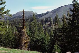
The Entiat Mountains, or Entiat Range is a mountain range in the U.S. state of Washington. Located west of the Columbia River, north of the Wenatchee River, and south of the Entiat River, the range is part of the North Cascades section of the Cascade Range. The Entiat Range is relatively narrow east to west and long north to south. The Entiat River valley separates the Entiat Mountains from the Chelan Mountains to the northeast. To the west and south, across the Wenatchee River and tributaries such as the Chiwawa River are the Wenatchee Mountains.
Map of Entiat Mountains, Washington 98826, USA
The Entiat Mountains stretch south to the Columbia River between the mouths of the Entiat and Wenatchee Rivers. The northern end the Entiat Range merges with the northern end of the Chelan Mountains. Most of the range is within Wenatchee National Forest. The northern end is part of the Glacier Peak Wilderness.
The highest peak of the Entiat Mountains is Mount Fernow, at 9,249 ft (2,819 m). Other major peaks include Seven Fingered Jack, Mount Maude, Copper Peak, Dumbell Mountain, Spectacle Buttes, and Buckskin Mountain. All these peaks are over 8,000 ft (2,400 m) and the three highest are over 9,000 ft (2,700 m). They are all located in the northern part of the Entiat Range. The highest peaks of the southern portion are under 7,000 ft (2,100 m). Significant peaks of the southern Entiat Range include Cougar Mountain, Tyee Mountain, Sugarloaf Peak, Chumstick Mountain, and Burch Mountain.
The name comes from the Entiat tribe. A large number of place names, including many of the mountains, were given by Albert H. Sylvester.
In July 2014, several wildfires, including the Mills Canyon Fire and the Kelly Mountain Fire, burned in the Entiat Mountains.