
Demonym(s) Elmoron Area 1,702 km² Population 80,902 (2013) | Congressional district 2nd Website www.elmoreco.org Founded 15 February 1866 | |
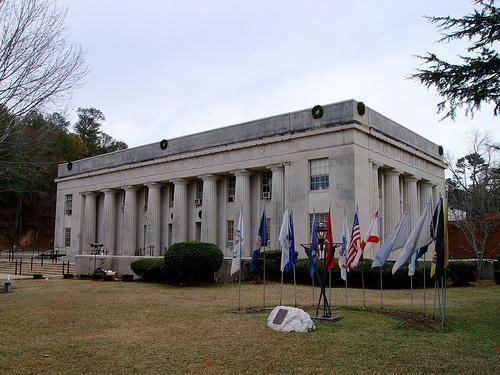 | ||
University J. F. Ingram State Technical College Points of interest Jasmine Hill Gardens, Town of Spectre, Swayback Bridge Trail, El County Historical, Replica Of Fort Toulouse III | ||
Elmore county alabama reckless driving attorney lawyer for elmore county al reckless driving
Elmore County is a county of the State of Alabama. As of the 2010 census, the population was 79,303. Its county seat is Wetumpka. Its name is in honor of General John A. Elmore.
Contents
- Elmore county alabama reckless driving attorney lawyer for elmore county al reckless driving
- Map of Elmore County AL USA
- National register of historic places listings in elmore county alabama top 5 facts
- History
- Geography
- Major highways
- Adjacent counties
- Demographics
- 2010 census
- Government and infrastructure
- Economy
- Education
- Cities
- Towns
- Census designated places
- Unincorporated communities
- References
Map of Elmore County, AL, USA
Elmore County is part of the Montgomery, AL Metropolitan Statistical Area.
National register of historic places listings in elmore county alabama top 5 facts
History
Elmore County was established on February 15, 1866, from portions of Autauga, Coosa, Tallapoosa, and Montgomery counties.
Geography
According to the U.S. Census Bureau, the county has a total area of 657 square miles (1,700 km2), of which 618 square miles (1,600 km2) is land and 39 square miles (100 km2) (5.9%) is water.
Major highways
Adjacent counties
Demographics
As of the census of 2000, there were 65,874 people, 22,737 households, and 17,552 families residing in the county. The population density was 106 people per square mile (41/km2). There were 25,733 housing units at an average density of 41 per square mile (16/km2). The racial makeup of the county was 77.02% White, 20.64% Black or African American, 0.43% Native American, 0.36% Asian, 0.03% Pacific Islander, 0.48% from other races, and 1.04% from two or more races. 1.22% of the population were Hispanic or Latino of any race.
There were 22,737 households out of which 37.40% had children under the age of 18 living with them, 61.40% were married couples living together, 12.00% had a female householder with no husband present, and 22.80% were non-families. 20.00% of all households were made up of individuals and 7.70% had someone living alone who was 65 years of age or older. The average household size was 2.66 and the average family size was 3.07.
In the county, the population was spread out with 25.70% under the age of 18, 8.80% from 18 to 24, 32.10% from 25 to 44, 22.70% from 45 to 64, and 10.70% who were 65 years of age or older. The median age was 35 years. For every 100 females there were 102.50 males. For every 100 females age 18 and over, there were 101.30 males.
The median income for a household in the county was $41,243, and the median income for a family was $47,155. Males had a median income of $32,643 versus $24,062 for females. The per capita income for the county was $17,650. About 7.40% of families and 10.20% of the population were below the poverty line, including 14.20% of those under age 18 and 11.30% of those age 65 or over. In the late 1990s voters voted to pass a mandatory fire fee for volunteer fire services. All citizens pay this same fee regardless of valuation of the property or income levels.
2010 census
As of the census of 2010, there were 79,303 people, 28,301 households, and 21,003 families residing in the county. The population density was 128 people per square mile (49/km2). There were 32,657 housing units at an average density of 49.7 per square mile (19.2/km2). The racial makeup of the county was 76.2% White, 20.0% Black or African American, 0.4% Native American, 0.7% Asian, 0.1% Pacific Islander, 1.2% from other races, and 1.4% from two or more races. 2.7% of the population were Hispanic or Latino of any race.
There were 28,301 households out of which 32.5% had children under the age of 18 living with them, 56.6% were married couples living together, 13.1% had a female householder with no husband present, and 25.8% were non-families. 22.0% of all households were made up of individuals and 7.8% had someone living alone who was 65 years of age or older. The average household size was 2.61 and the average family size was 3.04.
In the county, the population was spread out with 23.6% under the age of 18, 9.3% from 18 to 24, 27.9% from 25 to 44, 27.4% from 45 to 64, and 11.9% who were 65 years of age or older. The median age was 37.8 years. For every 100 females there were 95.3 males. For every 100 females age 18 and over, there were 94.7 males.
The median income for a household in the county was $53,128, and the median income for a family was $62,870. Males had a median income of $46,952 versus $31,542 for females. The per capita income for the county was $22,640. About 9.1% of families and 12.4% of the population were below the poverty line, including 16.8% of those under age 18 and 9.4% of those age 65 or over.
Government and infrastructure
The Julia Tutwiler Prison for Women of the Alabama Department of Corrections is in Wetumpka in Elmore County. The prison houses Alabama's female death row. Wetumpka was previously the site of the Wetumpka State Penitentiary.
Economy
Over the past two decades, Elmore County has transferred from an economy based on agriculture to one of Alabama's fastest-growing counties. According to a recent report, 1110 jobs were created over the last 4 years.
Elmore County's largest employer is the manufacturing sector. The top ten manufacturers in Elmore County include: GKN Aerospace, Neptune Technologies, Frontier Yarns, Russell Corporation, Madix, Inc, Arrowhead Composites, Hanil USA, YESAC Alabama Corporation, Quality Networks, Inc., and AES Industries.
Education
The Elmore County Public School System serves the county.