
Country United States FIPS code 01-17176 Elevation 55 m Population 1,232 (2013) Area code 334 | Time zone Central (CST) (UTC-6) GNIS feature ID 0137171 Zip code 36020 Local time Sunday 6:14 PM | |
 | ||
Weather 16°C, Wind N at 2 km/h, 64% Humidity Area 18.91 km² (18.39 km² Land / 52 ha Water) | ||
Help coosada alabama traffic speeding ticket lawyer best coosada al traffic attorney
Coosada is a town in Elmore County, Alabama, United States. At the 2010 census the population was 1,224. It is part of the Montgomery Metropolitan Statistical Area.
Contents
- Help coosada alabama traffic speeding ticket lawyer best coosada al traffic attorney
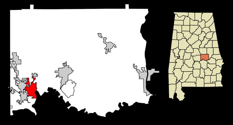
- Map of Coosada AL USA
- Geography
- Demographics
- 2010 census
- Notable people
- References
Map of Coosada, AL, USA
Geography
Coosada is located at 32°30′15″N 86°20′3″W (32.504197, -86.334120).
According to the U.S. Census Bureau, the town has a total area of 7.3 square miles (19 km2), of which 7.2 square miles (19 km2) is land and 0.2 square miles (0.52 km2) (3.37%) is water.
Demographics
Note the 1880 U.S. Census figure was for the unincorporated community of Coosada Station. Coosada was not incorporated until the 1970s.
As of the census of 2000, there were 1,382 people, 472 households, and 370 families residing in the town. The population density was 196.1 people per square mile (75.7/km2). There were 529 housing units at an average density of 75.1 per square mile (29.0/km2). The racial makeup of the town was 56.08% White, 42.55% Black or African American, 0.36% Native American, 0.14% Asian, 0.22% from other races, and 0.65% from two or more races. 0.65% of the population were Hispanic or Latino of any race.
There were 472 households out of which 39.0% had children under the age of 18 living with them, 58.3% were married couples living together, 15.0% had a female householder with no husband present, and 21.6% were non-families. 19.3% of all households were made up of individuals and 7.8% had someone living alone who was 65 years of age or older. The average household size was 2.93 and the average family size was 3.38.
In the town, the population was spread out with 31.9% under the age of 18, 8.2% from 18 to 24, 29.1% from 25 to 44, 20.5% from 45 to 64, and 10.3% who were 65 years of age or older. The median age was 32 years. For every 100 females there were 95.8 males. For every 100 females age 18 and over, there were 90.1 males.
The median income for a household in the town was $39,405, and the median income for a family was $44,118. Males had a median income of $30,444 versus $22,411 for females. The per capita income for the town was $16,219. About 7.7% of families and 10.9% of the population were below the poverty line, including 17.4% of those under age 18 and 11.7% of those age 65 or over.
2010 census
As of the census of 2010, there were 1,224 people, 434 households, and 340 families residing in the town. The population density was 172.3 people per square mile (66.5/km2). There were 487 housing units at an average density of 66.7 per square mile (25.6/km2). The racial makeup of the town was 57.7% White, 40.0% Black or African American, 0.4% Native American, 0.2% Asian, 1.1% from other races, and 0.7% from two or more races. 2.9% of the population were Hispanic or Latino of any race.
There were 472 households out of which 32.0% had children under the age of 18 living with them, 54.4% were married couples living together, 17.7% had a female householder with no husband present, and 21.7% were non-families. 18.9% of all households were made up of individuals and 8.5% had someone living alone who was 65 years of age or older. The average household size was 2.82 and the average family size was 3.19.
In the town, the population was spread out with 27.0% under the age of 18, 8.0% from 18 to 24, 24.3% from 25 to 44, 27.2% from 45 to 64, and 13.6% who were 65 years of age or older. The median age was 38.1 years. For every 100 females there were 96.5 males. For every 100 females age 18 and over, there were 98.4 males.
The median income for a household in the town was $47,904, and the median income for a family was $53,462. Males had a median income of $41,336 versus $24,659 for females. The per capita income for the town was $18,636. About 10.6% of families and 15.5% of the population were below the poverty line, including 18.8% of those under age 18 and 12.7% of those age 65 or over.
Notable people
James Sanders Walker, brother to Alabama Senator John W Walker, died 1825. Son of Rev. Jeremiah Walker of VA/NC/GA fame.