
Country United States Time zone Eastern (EST) (UTC-5) FIPS code 13-27092 Elevation 390 m | Area code(s) 706/762 GNIS feature ID 0331651 Zip code 30540 | |
 | ||
Weather 2°C, Wind SE at 0 km/h, 64% Humidity Points of interest Gilmer County Historical, Gilmer County Parks, Whistle Tree Pottery | ||
Ellijay is a city in Gilmer County, Georgia, United States. The population was 1,619 at the 2010 census. The city is the county seat of Gilmer County.
Contents
- Map of Ellijay GA 30540 USA
- History
- Geography
- Demographics
- Government
- Higher education
- Gilmer County School District
- References
Map of Ellijay, GA 30540, USA
The city holds an annual Georgia Apple Festival in October, and Gilmer County is known as the "Apple Capital of Georgia".
Former President Jimmy Carter has a log cabin second home in Ellijay.
History
Ellijay is the anglicized form of the Cherokee name Elatseyi, meaning "new ground". Other sources say it means "green place".
Gilmer County was cut from Cherokee County in 1832, and Ellijay became the county seat in 1834. Ellijay existed as a remote mountain community until the Marietta and Northern Georgia Railroad (later the L & N) arrived in 1884. This prompted something of a boom in the timber industry, but the area remained relatively isolated until the Zell Miller Mountain Parkway (Georgia 515, named for Georgia governor and U.S. senator Zell Miller) was completed in 1991.
Geography
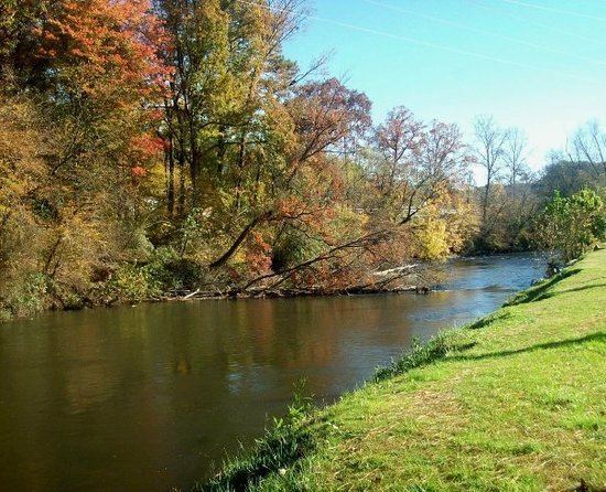
Ellijay is located at the center of Gilmer County, at 34°41'41" north, 84°29'1" west (34.694656, -84.483566). According to the United States Census Bureau, the city has a total area of 3.6 square miles (9.2 km2), all of it land. It is situated at the confluence of the Ellijay and Cartecay rivers, forming the Coosawattee River, part of the Oostanaula/Coosa/Alabama River watershed. It is bordered to the east and south by the city of East Ellijay.
U.S. Route 76 bypasses the city center to the south and east. It leads west 24 miles (39 km) to Chatsworth and northeast 16 miles (26 km) to Blue Ridge. Georgia State Route 52 (Chatsworth Highway) also leads 24 miles (39 km) to Chatsworth, taking a more northerly route over Cohutta Mountain. Georgia State Route 515, the Zell Miller Mountain Parkway, leads northeast with US 76 to Blue Ridge and south 20 miles (32 km) to Jasper. Downtown Atlanta is 77 miles (124 km) to the south.
Demographics
As of the census of 2000, there were 1,584 people, 593 households, and 342 families residing in the city. The population density was 591.7 people per square mile (228.2/km2). There were 662 housing units at an average density of 247.3 per square mile (95.4/km2). There were 662 housing units at an average density of 247.3 per square mile (95.4/km2). The racial makeup of the city was 81.25% White, 1.39% African American, 0.00% Native American, 1.70% Asian, 0.57% Pacific Islander, 12.50% from other races, and 2.46% from two or more races. Hispanic or Latino of any race were 25.19% of the population.
There were 593 households out of which 26.8% had children under the age of 18 living with them, 36.1% were married couples living together, 16.5% had a female householder with no husband present, and 42.2% were non-families. 37.6% of all households were made up of individuals and 20.4% had someone living alone who was 65 years of age or older. The average household size was 2.49 and the average family size was 3.14.
In the city, the population was spread out with 22.9% under the age of 18, 10.5% from 18 to 24, 25.0% from 25 to 44, 19.7% from 45 to 64, and 21.9% who were 65 years of age or older. The median age was 38 years. For every 100 females there were 93.2 males. For every 100 females age 18 and over, there were 88.9 males.
The median income for a household in the city was $22,120, and the median income for a family was $36,250. Males had a median income of $21,875 versus $20,469 for females. The per capita income for the city was $13,740. About 20.3% of families and 27.5% of the population were below the poverty line, including 27.3% of those under age 18 and 31.7% of those age 65 or over.
Government
Ellijay is governed by a five-member city council and a mayor. The current mayor is William Albert "Al" Hoyle.
Higher education
Dalton State College - Gilmer County Center
Gilmer County School District
The Gilmer County School District holds pre-school to grade twelve, and consists of four elementary schools, two middle schools, and a high school. There is also Crossroads, which is the alternative school in Ellijay.