
Length 31 km Country United States of America | Basin area 351 km² | |
 | ||
Source Chattahoochee-Oconee National Forest | ||
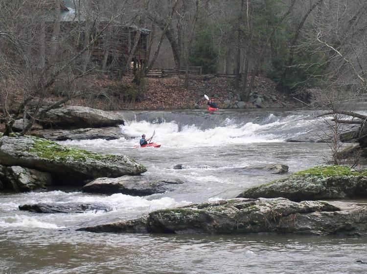
Cartecay river kayaking ellijay ga 052810
The Cartecay River is a 19.1-mile-long (30.7 km) river that runs through Ellijay, Georgia. It is the site of a class II whitewater run.
Contents
- Cartecay river kayaking ellijay ga 052810
- Map of Cartecay River Ellijay GA USA
- River surfing the cartecay river in ellijay georgia
- References
Map of Cartecay River, Ellijay, GA, USA
The Cartecay and Ellijay rivers meet in Ellijay to form the Coosawattee River. The Cartecay and most of its watershed are located within the southeast corner of Gilmer County, Georgia, but there are small sections of the watershed in Fannin, Pickens, and Dawson counties.
Much of the river runs east to west near or along Georgia State Route 52. The Cartecay River basin covers 86,734 acres (351.0 km2) in total area. The major tributaries are Clear Creek, Licklog Creek, Owltown Creek, Anderson Creek and Tickanetley Creek. The land is mostly undeveloped, but the river does pass through residential developments. The headwaters of the Cartecay River begin in the Chattahoochee National Forest.
The Cartecay River is a recreational river for kayaking, canoeing and tubing.