
Population 574 (2001) Sovereign state United Kingdom Local time Tuesday 8:02 PM | OS grid reference SK267283 Post town DERBY Dialling code 01283 | |
 | ||
Weather 8°C, Wind S at 14 km/h, 60% Humidity | ||
Egginton is a village and civil parish in the local government district of South Derbyshire, England. The population of the civil parish at the 2011 Census was 574.
Contents
Map of Egginton, Derby, UK
Location
The village is located just off Ryknild Street, otherwise known as the A38, between Derby and Stretton, Burton upon Trent. It is historically a farming community. Due to a historical legal situation, no alcohol is allowed to be sold in the village and hence there is no village pub.
In Fishpond Lane there is a row of tenants' cottages, some of which have their windows bricked up, dating back to the days of window-tax.
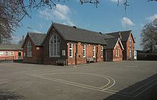
The village does not have a war memorial in the normal sense but it has a memorial hall which doubles as the village school and as a community hall.
Airfield
After the closure of the former Burnaston Airport nearby, Derby Airfield was established at Egginton. The small airfield houses a community of light aircraft owners, an aero club and supporting aircraft maintenance firms.