
Population 14,092 (2011) Post town PLYMOUTH Dialling code 01752 | Sovereign state United Kingdom Postcode district PL3 6xx | |
 | ||
UK parliament constituency Plymouth Sutton and Devonport | ||
Efford is a large, mostly post-war, eastern suburb of Plymouth in the county of Devon, England.
Contents
Map of Efford, Plymouth, UK
It stands on high ground above the Laira estuary of the River Plym and variously offers views over long distances: to the north across Dartmoor, to the east and south-east across the South Hams of Devon. It has a core of home owners but is predominantly made up of local authority and housing association properties.
Etymology
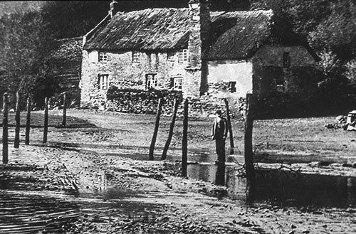
One theory of the origin of the name 'Efford' is that it originally comes from the part of this suburb that slopes down towards the River Plym (which is now partly reclaimed and built-on land); before much of the river silted up, ships could Ford here when the river was at the Ebb tide; so it was the Ebbing or Ebb-Ford. Over time, by the natural processes of pronunciation change, the 'b's disappeared and it became Efford. Before this land was built on, it was known as 'The Wilds of Efford', which was largely unspoilt countryside and marsh land. Another theory is that 'Efford' comes from the 'ford', which spanned the Plym from Crabtree to Saltram House. It was only usable during low tide 'ebb', hence the name ebb-ford and later, Efford.
History
Historically the area around Efford had military importance. Efford Fort (at 50°23′26″N 4°5′32″W) was one of the ring of Victorian Palmerston's Follies built to provide defence from risk of French invasion. The area was also heavily occupied by the American army during the preparations for D-Day. This is remembered by the naming of a part of Efford, where an estate of American-supplied prefab houses was built from 1945 onwards, as Little America. Streets there were given names such as California Gardens, Oregon Way etc. These names were retained when the estate was demolished and replaced by modern houses in the 1970s.
Efford Cemetery
A municipal cemetery for Plymouth city, initially 37 acres, was laid out at Efford from 1904 and opened in 1907. It is still in use. Amongst burials are:
In 1934 Plymouth's City Crematorium was opened within the cemetery. Among those cremated there were: