
Population 8,156 (2011 census) Local time Saturday 12:25 AM | Postcode(s) 6232 Postal code 6232 | |
 | ||
Weather 16°C, Wind SE at 19 km/h, 65% Humidity | ||
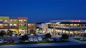
Eaton is a northeastern suburb of Bunbury, Western Australia, 7 km from the centre of Bunbury on the south shore of the Collie River. Its local government area is the Shire of Dardanup, and the offices for the Shire are located within the suburb. Eaton contains a state high school, Eaton Community College, and two state primary schools, Eaton and Glen Huon and a shopping centre called Eaton Fair, which has been recently expanded.
Map of Eaton WA 6232, Australia
References
Eaton, Western Australia Wikipedia(Text) CC BY-SA