
Primary inflows Surface area 1,780 acres (720 ha) Area 7.203 km² | Surface elevation 138 m Inflow source Chowchilla River Lake type Reservoir | |
 | ||
Primary outflows Chowchilla RiverTerminal (evaporation) References U.S. Geological Survey Geographic Names Information System: Eastman Lake | ||
Riverrat tournament eastman lake 2016
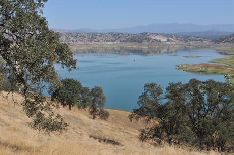
H. V. Eastman Lake is an artificial lake formed by the construction of Buchanan Dam across the Chowchilla River in the foothills of Madera County, California. A small percentage of the northwest area of the reservoir is in Mariposa County.
Contents
- Riverrat tournament eastman lake 2016
- Map of Eastman Lake Raymond CA 93653 USA
- Day trip to eastman lake 2 12 17
- References
Map of Eastman Lake, Raymond, CA 93653, USA
Buchanan Dam was a 1975 flood control and irrigation project of the United States Army Corps of Engineers. The earthen dam, 218 feet high with a length of 1746 feet at the crest, impounding a maximum capacity of 150,000 acre-feet of Chowchilla River water in the reservoir, is owned and operated by the Corps.
Day trip to eastman lake 2 12 17
References
Eastman Lake Wikipedia(Text) CC BY-SA