
Topo map USGS Quill Hill Prominence 550 m | Elevation 1,155 m Mountain range Appalachian Mountains | |
 | ||
Listing New England 100 Highest #91 Easiest route logging roads, then bushwhack Similar Boundary Peak, The Horn, Mount Redington, Saddleback Horn, Mount Nancy | ||
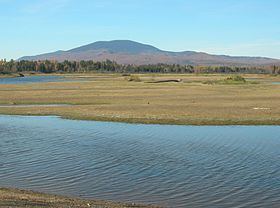
East Kennebago Mountain is a trailless mountain located in Franklin County, Maine. East Kennebago Mtn. is a monadnock, flanked by its spurs: Tim Mountain to the north, Black Spur to the west, and Blackcat Mountain to the southwest.
Contents
Map of East Kennebago Mountain, North Franklin, ME 04936, USA
The southeast side of East Kennebago Mountain drains into the South Branch of the Dead River, thence into Flagstaff Lake, the Dead River, and the Kennebec River, which drains into the Gulf of Maine. The northeast end of East Kennebago drains into Cherry Run, thence into the South Branch of the Dead River. The southwest end of East Kennebago drains into Kennebago Lake, thence into the Kennebago River, Cupsuptic Lake, through a series of lakes into the Rapid River and Umbagog Lake, the source of the Androscoggin River, which drains into Merrymeeting Bay, the estuary of the Kennebec River. The northwest side of East Kennebago drains into Big Sag Brook, thence into Kennebago Lake.