
Length 97 km Bridges Red Cliff Bridge | Basin size 945 sq mi (2,450 km) Basin area 2,450 km² Country United States of America | |
 | ||
River mouth Confluence with Colorado River6,122 ft (1,866 m) Discharge Average rate:577 cu ft/s (16.3 m/s) Sources South Fork Eagle River, East Fork Eagle River | ||
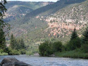
The Eagle River is a tributary of the Colorado River, approximately 60.5 miles (97.4 km) long, in west central Colorado in the United States.
Map of Eagle River, Colorado, USA
It rises in southeastern Eagle County, at the continental divide, and flows northwest past Gilman, Minturn, Avon. Near Wolcott, it turns west, flowing past Eagle and Gypsum, and joins the Colorado at Dotsero, in western Eagle County.
The Eagle is navigable by typical small river craft upstream to Vail in most years. Its flow ranges from 200 cu ft/s (5.7 m3/s) in late summer of dry years to 7,000 cu ft/s (200 m3/s) during spring runoff.
Acid mine drainage from the abandoned Eagle Mine has entered the river.
References
Eagle River (Colorado) Wikipedia(Text) CC BY-SA