
County Eagle Time zone MST (UTC-7) Elevation 2,012 m Local time Thursday 1:34 PM | Incorporated (town) April 5, 1905 ZIP code 81631 (PO Box) Population 6,522 (2013) | |
 | ||
Weather 16°C, Wind W at 26 km/h, 20% Humidity Area 11.94 km² (11.89 km² Land / 5 ha Water) | ||
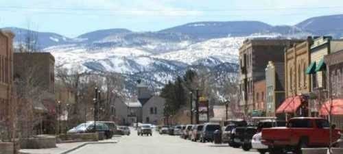
Eagle colorado driving tour of eagle
Eagle is a statutory town that is the county seat of Eagle County, Colorado, United States. The population was 6,508 at the 2010 census, up from 3,032 at the 2000 census.
Contents
- Eagle colorado driving tour of eagle
- Map of Eagle CO 81631 USA
- History
- Geography
- Demographics
- Community activism
- Climate
- Transportation
- References
Map of Eagle, CO 81631, USA
The town is gaining recognition for its extensive trail system for mountain biking, hiking and trail running. Located just 30 miles (48 km) west of the resorts of Vail and Beaver Creek, the town of Eagle and its residents enjoy an abundance of year-round recreational opportunities.
History
A post office called Eagle has been in operation since 1891. The town takes its name from Eagle County. Eagle was incorporated in 1905.
Geography
Eagle is located west of the center of Eagle County in the valley of the Eagle River, a west-flowing tributary of the Colorado River. The town limits extend southward up the valley of Brush Creek. U.S. Route 6 passes through the center of town, and Interstate 70 passes through the northern side, with access from Exit 147. Vail is 30 miles (48 km) to the east, and Glenwood Springs is 31 miles (50 km) to the west.
According to the U.S. Census Bureau, the town has a total area of 4.6 square miles (11.9 km2), of which 0.02 square miles (0.05 km2), or 0.44%, is water.
Demographics
As of the 2010 census, there were 6,508 people, 2,183 households, and 1,666 families residing in the town. The population density was 1,417.9 people per square mile (547.5/km²). There were 2,416 housing units at an average density of 526.4 per square mile (203.2/km²). The racial makeup of the town was 87.3% white, 0.4% African American, 0.8% Native American, 0.8% Asian, 0.02% Pacific Islander, 7.9% some other race, and 2.6% from two or more races. Hispanic or Latino of any race were 22.3% of the population.
There were 2,183 households, out of which 49.5% had children under the age of 18 living with them, 65.5% were headed by married couples living together, 6.7% had a female householder with no husband present, and 23.7% were non-families. 16.3% of all households were made up of individuals, and 4.1% were someone living alone who was 65 years of age or older. The average household size was 2.96 and the average family size was 3.33.
In the town, the population was spread out with 31.7% under the age of 18, 5.8% from 18 to 24, 35.8% from 25 to 44, 22.7% from 45 to 64, and 4.1% who were 65 years of age or older. The median age was 33.8 years. For every 100 females there were 104.5 males. For every 100 females age 18 and over, there were 102.9 males.
For the period 2010–14, the estimated median annual income for a household in the town was $81,571, and the median income for a family was $94,875. Male full-time workers had a median income of $65,156 versus $47,902 for females. The per capita income for the town was $35,426. About 2.0% of families and 4.2% of the population were below the poverty line, including 2.8% of those under age 18 and 28.2% of those age 65 or over.
Community activism
The Eagle community has an involved community, especially when big issues come up for review. In just three years, there were three referendums. In January 2010, voters defeated a 582,000-square-foot (54,100 m2) lifestyle center project called Eagle River Station. In January 2012, voters approved allowing the medical marijuana dispensary to stay in business. (The Board of Trustees originally allowed the business to open but then the new Board of Trustees decided to withdraw that permit. The owners of the marijuana dispensary then took it to the vote of the people and the business was allowed to stay open.) In May 2012, voters approved the second vote on the now 732,000-square-foot (68,000 m2) lifestyle center project still called Eagle River Station.
Climate
Eagle experiences a semi-arid climate with cold winters and hot summers. Due to the high elevation, temperatures drop sharply after sunset.
Transportation
Eagle County Regional Airport (IATA:EGE, ICAO:KEGE) is 5 miles (8 km) to the west, located between Eagle and the town of Gypsum. Many airlines provide services from Eagle to various destinations during the ski season months, although in the low season months the airport just has services to Dallas and Denver. ECO Transit provides local transportation from Eagle to Dotsero, Gypsum, Edwards, Avon and Vail.
Union Pacific Railroad's tracks cross Eagle, linking the town to Denver, Grand Junction, and Pueblo. The closest Amtrak station is located in Glenwood Springs, 31 miles (50 km) to the west, with daily service of the California Zephyr.