
 | ||
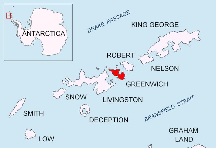
Dryanovo Heights (Dryanovski Vazvisheniya \'drya-nov-ski v&-zvi-'she-ni-ya) The ice-covered heights rising to 520 m in the northwest part of Greenwich Island. Extending 13 km in northwest-southeast direction, and 7 km in northeast-southwest direction. Featuring Mount Plymouth in the east, Crutch Peaks in the northwest, Lloyd Hill in the southwest, and Malamir Knoll in the southeast.
Contents
Map of Dryanovo Heights, Antarctica
Named after the Bulgarian town of Dryanovo.
Registered in the SCAR Composite Antarctic Gazetteer.
Location
The midpoint of the feature is located at 62°28′50″S 59°52′10″W.
Maps
References
Dryanovo Heights Wikipedia(Text) CC BY-SA