
 | ||
Dronagiri new node of navi mumbai
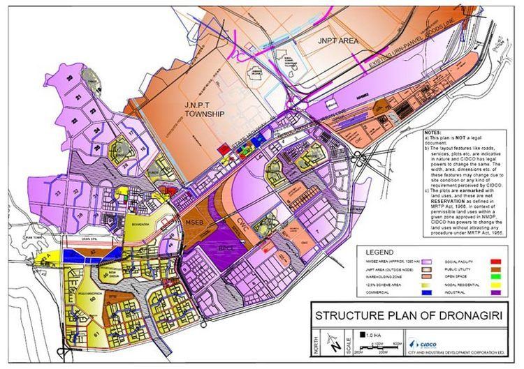
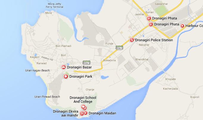
The Dronagiri, Navi Mumbai zone is spread over an area of 1,250 ha and is located at the southern tip of Navi Mumbai, India. The zone is located to the east of Uran town, and is bound by the Karanja River on the south-east. Residential areas are located to the west and north-west of the zone, while the Jawaharlal Nehru Port (JNPT) area and township are located towards the north of the zone. The zone is adjacent to the JNPT port, and is located farthest from the central business districts of Belapur, Nerul and Vashi. Due to its proximity to the port, this zone is ideal for port-based industries.
Contents
- Dronagiri new node of navi mumbai
- Jt hep dronagiri sanjivni expedition blissful and enjo
- Introduction
- Topography
- Navi Mumbai International Airport
- References
Jt hep dronagiri sanjivni expedition blissful and enjo
Introduction
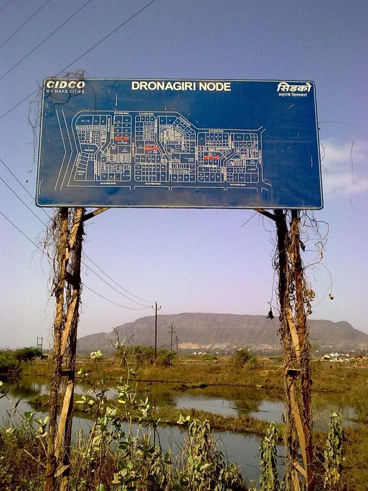
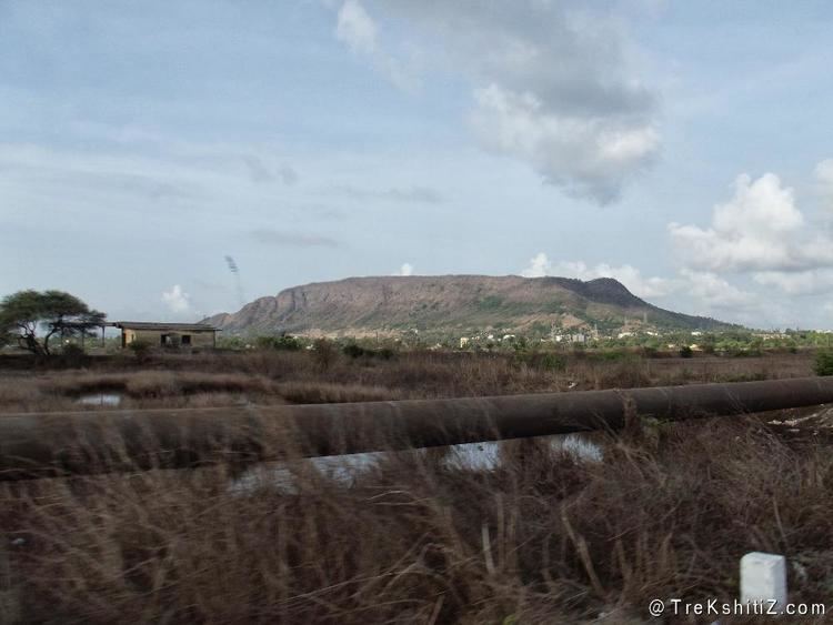
Navi Mumbai is envisaged as a metro sized counter magnet to reduce the pressure on the Mumbai metropolis. It is planned as a polycentric new town with a series of nodal concentrations along mass-transport corridors. When fully built, it is expected to have 14 such townships with a combined population holding capacity of four millions and one million jobs. Dronagiri is one of these 14 nodes and is being developed by CIDCO. On the mountain near the sea is situated Dronagiri Fort.
Topography
The topography includes a hilly region towards the west of the zone.The region receives rather heavy rainfall regularly during the months of August through November and in order to ensure proper drainage of the area, CIDCO has constructed holding ponds in the area to allow water to accumulate during high tide and heavy downpour. During low tide, water from the holding ponds flows back into the sea.

The zone is characterised by loose soil with lowbearing capacity, and black stiff clay. Construction work could, therefore, require pile foundation.
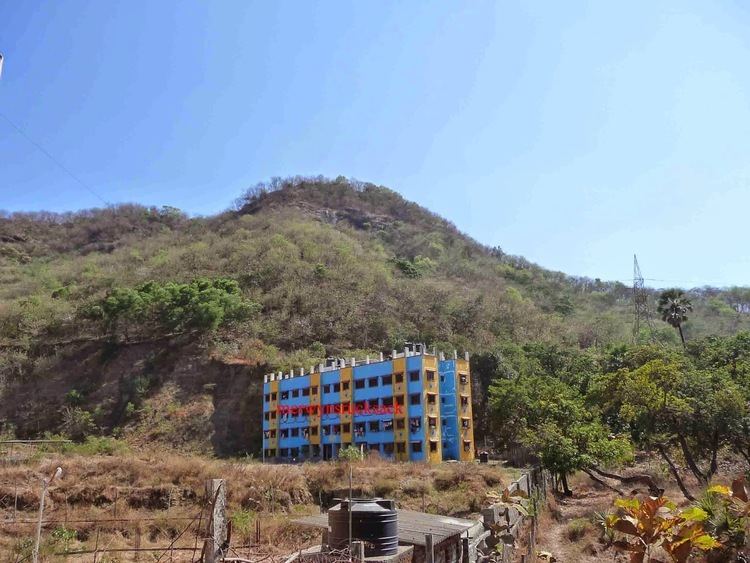
Basic infrastructure has already been developed in the zone, and around 350 ha (20 percent of land) has already been sold. In addition, around 90 ha is currently being used for commercial purposes. There is a multispeciality hospital 125 bedded called Carepoint Hospital. This is the only multispeciality hospital in this node.
Navi Mumbai International Airport
The Navi Mumbai airport was conceived because the Mumbai international airport. It is spread over an area of 1160 hectares.The proposed new Navi Mumbai International Airport was initially expected to be operational by 2014 in the Kopra area between Khandeshwar and Kamothe. This was passed by CIDCO on August 1, 2009. Despite getting environmental clearance from the Centre almost three years ago, the project was stuck due to protracted negotiations with farmers who wanted a compensation package of Rs 20 crore per hectare or 35 per cent of the land bank as a developed plot.
The project, which will come up on 1,160 hectares of land, will be built in four phases. The first phase with an annual capacity of 10 million passengers will be completed by 2019. After the completion of the whole project, it will cater to about 60 million passengers a year.
The affected villagers will mostly be rehabilitated in a new township called Pushpak Nagar and in Wadghar and Wahal villages around the project area. Under the project plan, the rare island village of Waghivali in Panvel creek will be converted into a mangrove lagoon and its ecology will be maintained
There is also a plan to build a sea link between Nhava Sheva and Sewri, thus making the new airport accessible to not only Navi Mumbai residents but also the residents of south Mumbai as well.