
OS grid reference SX315540 Post town TORPOINT Local time Saturday 3:28 AM | Postcode district PL11 Dialling code 01503 | |
 | ||
Weather 9°C, Wind E at 16 km/h, 100% Humidity | ||
Downderry (Cornish: Downderri) is a coastal village in southeast Cornwall, England, United Kingdom. It is situated 18 miles (29 km) west of Plymouth and one mile east of Seaton. According to the Post Office the 2011 census population was included in the civil parish of Deviok.
Contents
- Map of Downderry Torpoint UK
- Bass rock
- Coleadon
- The Brawn Shag rock
- Surf breaks
- Television transmitter
- Chain Home bunkers
- Neolithic earthworks
- Wreck of the Gipsy
- Alumni
- Artistic impression
- References
Map of Downderry, Torpoint, UK
Downderry has a long beach of light shingle. There is road access down to the beach via a slipway although this is blocked by a locked gate, pedestrian access is still possible. Dogs are allowed on the beach. The east beach has a reputation as a nudist beach.
The village and beach offer views of Looe Island to the west and Rame Head to the east and on clear days sight of the Eddystone Lighthouse 8 miles (13 km) to the south.
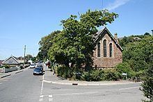
The village has a Church of England church, a Methodist chapel, a shop with a Post Office, a pub, a restaurant, a coffee shop and a primary school.
The Church of St Nicolas Downderry began as a mission church to service the growing population of the village. The building dates from the late 19th century.
Bass rock
Approximately 700 metres (770 yd) east of the village center is a rocky outcrop known locally as "Bass Rock", this is a popular fishing spot as it affords access to deeper water.
Coleadon
300 metres (330 yd) further on from Bass Rock are the cliffs of Coleadon, the promontory past these cliffs means access to the beach past this point is cut off at high tide.
The Brawn (Shag rock)
Past Coleadon is a 600 metres (660 yd) stretch of beach which ends in a rocky outcrop known locally as "Shag rock" after the seabirds of the same name who can be seen sitting on the rock drying their wings after diving for fish. This marks the end of easy foot access to the coastline. There is a path up the cliff which leads to the road above this beach, the climb is pleasant but reasonably strenuous. The ruins of an old Victorian lodge, known as "St Germans hut", can be found half way up this cliff path.
Surf breaks
There are two breaks of note within the village. One is situated almost directly off the slip-way of the main beach, a reef break which works best in fairly heavy swell on a mid-tide and it's possible to paddle out directly from the beach. The other, also a reef break, is located off of Downderry Primary School and requires a walk in across the rocks. Access is via a path down the side of the Primary School. There is an effluent pipe almost directly in line with this break this but it is no longer used!
Television transmitter
On one of the hills above the village is a television transmitter which serves as a repeater for the local area.
'Chain Home' bunkers
During World War II Downderry was the site of a Chain Home radar installation. The remains of this installation are present and can be found on the East side of the village. One of the bunkers has been converted into a residential garage, the other is accessible from the road but is hard to find in summer since the path is extremely overgrown.
Neolithic earthworks
The only known example of a 'cursus' earthwork in Cornwall is situated behind the village in the fields near Triffle farm.
Wreck of the Gipsy
The wreck of the Gipsy can be found just off of Downderry in about 7 metres (23 ft) of water 90 metres (300 ft) west of the slipway. Originally named 'The Rodney' she was an iron full-rigged ship built in 1874 by W. Pile & Co., Sunderland.
In Nov. 1895, Rodney lost her figurehead in a gale in the English Channel, while en route from Gravesend, Kent to Sydney. The figurehead washed ashore at Whitsand Bay, Cornwall, six months later.
In 1897, the ship was sold to F. Boissière, of Nantes, France, and renamed Gipsy (the cross-over year, per Lloyd's, is 1896/97). Re-rigged then as a Barque. On Dec. 7, 1901, the vessel was wrecked, a total loss, at Downderry on the return voyage from Iquique (Chile) to France with a cargo of nitrate. The 1,447 tonnes (1,424 long tons; 1,595 short tons) ship lost her bearings and became stranded on the reef. She was blown apart by explosives as she had become a hazard to local fishing vessels. Parts of the wreck are strewn over a large area in about 7 to 8 metres (23 to 26 ft) of water.
Alumni
Dan Joyce of Dirty Sanchez attended St Nicholas C of E School in the 1980s.
Artistic impression
Downderry! Downderry! The very name of this small Cornish seaside village has a rhythmic, lyrical quality... Downderry down, Downderry down... it rings of lymeric, folk song and rhyme. Snug between the bay of Whitsand and the promontory of Looe, Downderry with its spouse Seaton, bathes in the constant ebb and flow of the English Channel. Their gentle cliffs roll and tumble towards the sea.