
Postal code 739 38 Elevation 345 m Local time Thursday 6:38 PM | First mentioned 1305 Website www.ddomaslavice.cz Area 7.36 km² Population 1,055 (2006) | |
 | ||
Weather 5°C, Wind S at 8 km/h, 86% Humidity | ||
Sraz po 38 letech z doln domaslavice ro nik 1963
Dolní Domaslavice (Polish: Domasłowice Dolne, German: Nieder Domaslowitz) is a village in Frýdek-Místek District, Moravian-Silesian Region, Czech Republic. In 2006, it had a population of 1,055. It lies on the eastern shore of Žermanice Dam, in the historical region of Cieszyn Silesia.
Contents
- Sraz po 38 letech z doln domaslavice ro nik 1963
- Map of 739 38 DolnC3AD Domaslavice Czechia
- Radov nky 2016 doln domaslavice zumba vystoupen ivana pawlasov
- History
- References
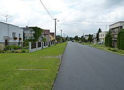
Map of 739 38 Doln%C3%AD Domaslavice, Czechia
Radov nky 2016 doln domaslavice zumba vystoupen ivana pawlasov
History
The village was first mentioned in a Latin document of Diocese of Wrocław called Liber fundationis episcopatus Vratislaviensis from around 1305 as item in Domaslawitz utroque. It meant that there were already two villages of that name (utroque meaning both in Latin), the other being Horní Domaslavice.
Politically the village belonged initially to the Duchy of Teschen, formed in 1290 in the process of feudal fragmentation of Poland and was ruled by a local branch of Piast dynasty. In 1327 the duchy became a fee of the Kingdom of Bohemia, which after 1526 became part of the Habsburg Monarchy.
After Revolutions of 1848 in the Austrian Empire a modern municipal division was introduced in the re-established Austrian Silesia. The village as a municipality was subscribed to the political and legal district of Cieszyn. According to the censuses conducted in 1880, 1890, 1900 and 1910 the population of the municipality grew from 955 in 1880 to 1061 in 1910 with a majority being native Czech-speakers (between 88.3% and 92.4%) accompanied by a small Polish-speaking minority (between 3.2% and 10.6%) and German-speaking people (at most 41 or 4.4% in 1880). In terms of religion in 1910 majority were Roman Catholics (94.3%), followed by Protestants (53 or 5%) and Jews (7 people).
After World War I, fall of Austria-Hungary, Polish–Czechoslovak War and the division of Cieszyn Silesia in 1920, it became a part of Czechoslovakia. Following the Munich Agreement, in October 1938 together with the Zaolzie region it was annexed by Poland, administratively adjoined to Cieszyn County of Silesian Voivodeship. It was then annexed by Nazi Germany at the beginning of World War II. After the war it was restored to Czechoslovakia.
The construction of Žermanice Dam on Lučina River in years 1951-1958 led to a partial flooding of Dolní Domaslavice and extraction of the eastern territory of the village to form a new municipality of Lučina in 1956.