
Flag Coat of arms 1910 est. 756,949 Founded 1742 | Area 5,147 km² Date dissolved 1918 | |
 | ||
1910 5,147 km² (1,987 sq mi) | ||
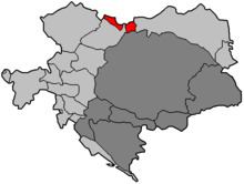
Austrian Silesia (German: Österreichisch Schlesien; Czech: Rakouské Slezsko; Polish: Śląsk Austriacki), officially the Duchy of Upper and Lower Silesia (German: Herzogtum Ober- und Niederschlesien; Czech: Vévodství Horní a Dolní Slezsko), was an autonomous region of the Kingdom of Bohemia and the Austrian Empire, from 1867 a Cisleithanian crown land of Austria-Hungary. It is largely coterminous with the present-day region of Czech Silesia, and was, historically, part of the larger Silesia region.
Contents
Geography
Austrian Silesia consisted of two territories, separated by the Moravian land strip of Moravská Ostrava between the Ostravice and Oder rivers.
The area east of the Ostravice around Cieszyn reached from the heights of the Western Carpathians (Silesian Beskids) in the south, where it bordered with the Kingdom of Hungary, along the Olza and upper Vistula rivers to the border with Prussian Silesia in the north. In the east the Biała river at Bielsko separated it from the Lesser Polish lands of the Polish–Lithuanian Commonwealth, incorporated into the Austrian Kingdom of Galicia and Lodomeria upon the First Partition of Poland in 1772.
The territory west of the Oder river stretching from the town of Opava up to Bílá Voda was confined by the Jeseníky mountain range of the eastern Sudetes in the south, separating it from Moravia, and the Opava river in the north. In the west the Golden Mountains formed the border with the County of Kladsko.
History
The area originally formed the south-eastern part of the Medieval Duchy of Silesia, a province of the Piast Kingdom of Poland. During the 14th century most Dukes of Silesia had declared themselves Bohemian vassals.
As part of the Lands of the Bohemian Crown, Silesia was inherited by the Habsburg archduke Ferdinand I of Austria in 1526, after the last Jagiellon king Louis II of Bohemia had died at the Battle of Mohács. With the female succession of the Habsburg empress Maria Theresa to the throne in 1740, the Prussian king Frederick the Great laid claim to the Silesian province and, without waiting for any reply, on 16 December started the First Silesian War, thereby opening the larger War of the Austrian Succession. His campaign was concluded in 1742 with the Prussian victory at the Battle of Chotusitz leading to the treaties of Breslau and Berlin, in which Silesia was divided.
Under the terms of the treaty, the Kingdom of Prussia received most of the territory including the Bohemian County of Kladsko, while only a small part of southeastern Silesia remained with the Habsburg Monarchy, consisting of:
forming the Duchy of Upper and Lower Silesia, which remained a Bohemian crown land with its capital in the city of Opava. In 1766 the title of a Duke of Teschen was granted to Prince Albert of Saxony, son-in-law of Maria Theresa, while the title of a Duke of Troppau and Jägerndorf remained with the Princely Family of Liechtenstein. The Nysa territory was held by the Bishops of Wrocław with their residence at Castle Jánský vrch (Johannisberg).
When in 1804 the Habsurg emperor Francis II established the Austrian Empire, his title would include the "Duke of Upper and Lower Silesia". Austrian Silesia was connected by rail with the Austrian capital Vienna, when the Emperor Ferdinand Northern Railway line was extended to Bohumín station in 1847. In the course of the Austro-Hungarian Compromise of 1867 the Duchy of Upper and Lower Silesia became a crown land of Cisleithanian Austria.
In 1918, the Austrian monarchy was abolished and the major part of Austrian Silesia was ceded to the newly created state of Czechoslovakia by the 1919 Treaty of Saint-Germain-en-Laye, with the exception of Cieszyn Silesia (the former Duchy of Teschen), which after the Polish–Czechoslovak War was split in 1920 along the Olza river with its eastern part falling to the Autonomous Silesian Voivodeship of Poland. Smaller parts of the duchy also became a part of Poland, while the adjacent Hlučín Region of Prussian Silesia fell to Czechoslovakia.
Demographics
According to an Austrian census, Austrian Silesia in 1910 was home to 756,949 people, speaking the following languages:
Major towns
Towns with more than 5,000 people in 1880:
Administration
The Duchy of Upper and Lower Silesia was originally divided into the two districts (Bezirke) of Teschen (Těšínský kraj, pop. 213,040 in 1847) and Troppau (Opavský kraj, pop. 260,199) with its seat at Krnov. In eastern Teschen, the autonomous Duchy of Bielsko was established in 1754. Upon the Revolutions of 1848 and up to its dissolution Austrian Silesia was intermittently re-organised into the districts of:
For example, in 1900, there were 8 Bezirkshauptmannschaften in Austrian Silesia (in comparison to above list without Frydek).