
Time zone EET (UTC+2) Licence plate 37 Elevation 235 m Local time Saturday 9:11 AM | Postal code 37xxx Climate Cfb Area 254 km² Area code 366 | |
 | ||
Weather 13°C, Wind SE at 6 km/h, 67% Humidity | ||
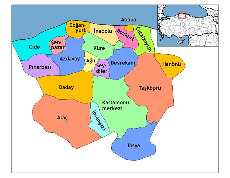
Doğanyurt, formerly Hoşalay, is a town and district of the Kastamonu Province in the Black Sea region of Turkey. According to the 2000 census, population of the district is 9,668 of which 1,470 live in the town of Doğanyurt. The district covers an area of 254 km2 (98 sq mi), and the town lies at an elevation of 235 m (771 ft).
Map of Do%C4%9Fanyurt, Merkez Mahallesi, 37550 Do%C4%9Fanyurt%2FKastamonu, Turkey
Kerembe Burnu, the ancient Cape Karambis, is located to the northwest of Doğanyurt. The promontory, 225 km distant from the Sarych headland, is the nearest point on the Anatolian coast to the Crimean Peninsula and has for centuries served as a nautical landmark for those seeking to cross the Black Sea at its narrowest point.
References
Doğanyurt Wikipedia(Text) CC BY-SA